For historical information only, do not use for navigation or aviation purposes!
| Coordinates | N530155 E0133233 (WGS84) Google Maps |
| Elevation | 202 ft |
| Location indicator | EDUT (200x) |

Germany during the Cold War Map
The history of the Cold War airfields: Templin
General
The Templin / Groß Dölln air base was built between 1952 and 1954 for the Soviet occupation troops in the GDR. The field was special not only because of the very spacious facilities. It also had an auxiliary runway, which ran from the airfield in a southwestern direction, with a remote dispersal area at the end.
West of the airfield were two storage areas. A SAM site was northwest of the field near Storkow. At NATO the airfield had different designations, first "Schorfheide", then "Groß Dölln" and finally "Templin".
During the Cold War
Use
Soviet air base.
Installations
The airfield area was stated with 1503.40 ha.
Remote dispersal area at the southern end of runway 01
Railway siding vom Vogelsang station
Related objects: SAM site near Storkow; Fuel depot Kurtschlag.
In the 1960s
Situation
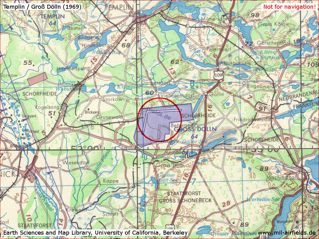
Templin Air Base on a US map from 1969 (Composed of two sheets)
Source: Earth Sciences and Map Library, University of California, Berkeley
Overview
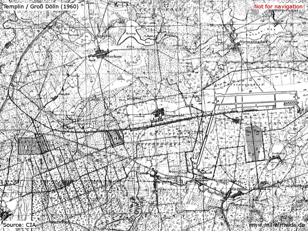
Map from ca. 1960 - The two depots at Kurtschlag and the accommodation area south of the airfield are hatched. The later SAM site near Storkow has not yet been noted.
Source: CIA
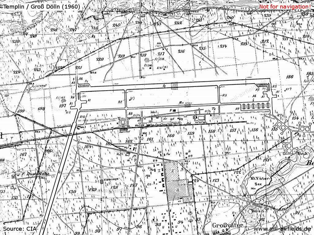
Map from ca. 1960 - The dispersal areas in the north and southeast were not built.
Source: CIA
In the 1970s
Situation

Templin Air Base on a map of the US Department of Defense from 1972
Source: ONC E-2 (1972), Perry-Castañeda Library Map Collection, University of Texas at Austin
Overview
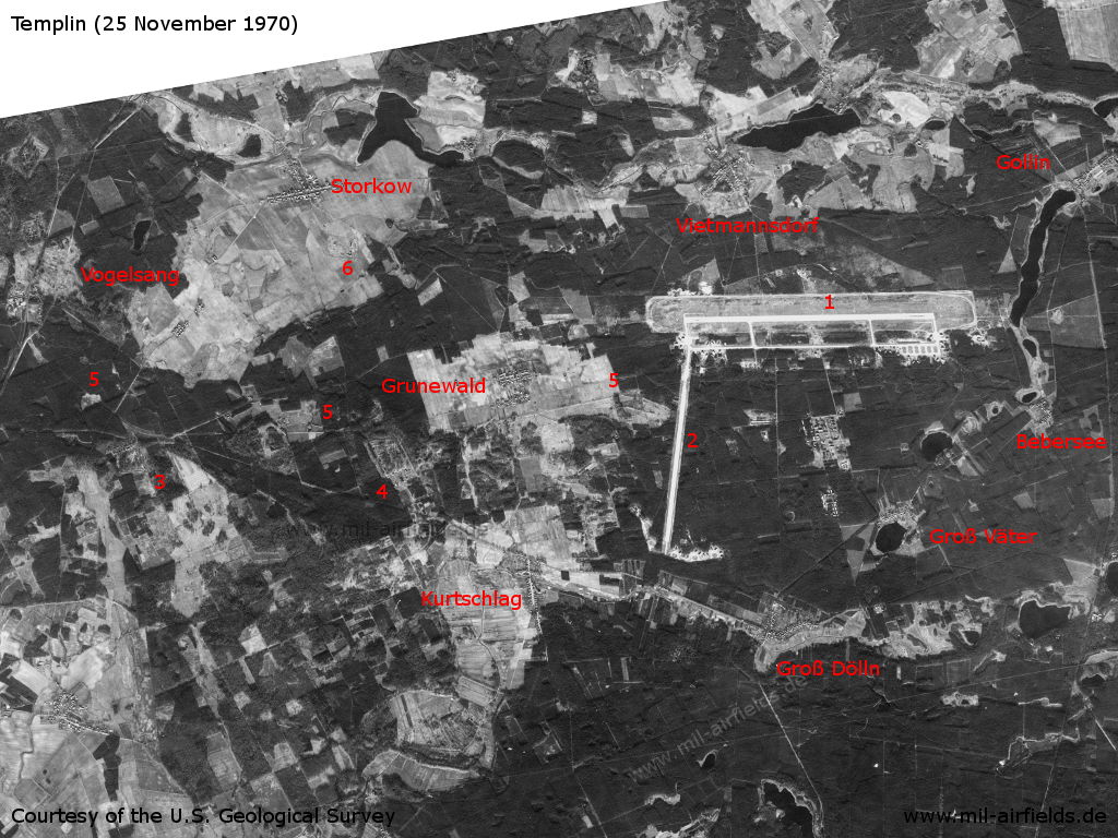
Templin Air Base on a US satellite image from 25 November 1970 - 1: Air base; 2: auxiliary runway; 3, 4: Depot; 5: railway siding; 6: Anti-aircraft missile site. Places Bebersee, Gollin, Groß Dölln, Groß Väter, Grunewald, Kurtschlag, Storkow, Vietmannsdorf, Vogelsang.
Source: U.S. Geological Survey
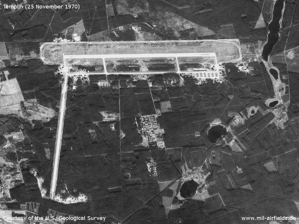
Air Base - The image is aligned so that the east-west runway is shown almost horizontal. However, since the image is distorted, the other angles are not correct.
Source: U.S. Geological Survey
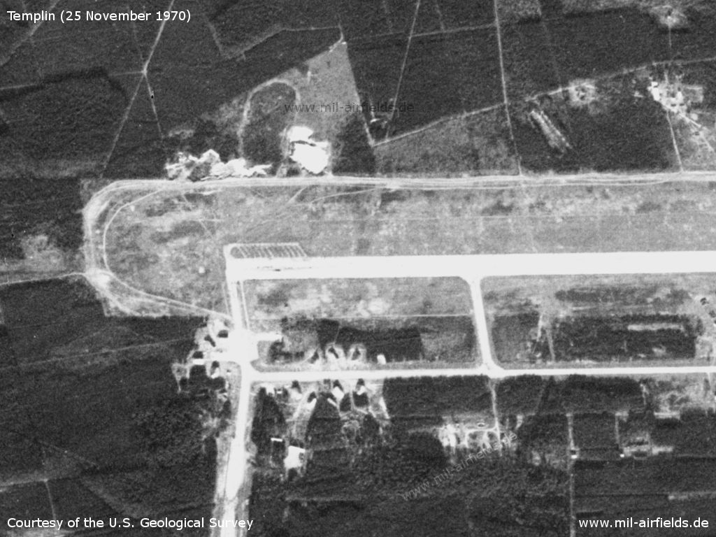
Enlargement of the western part - The airfield has numerous aircraft shelters. North of the runway there are 12 lanes for readiness aircraft. This can only be found at a few Soviet airfields.
Source: U.S. Geological Survey
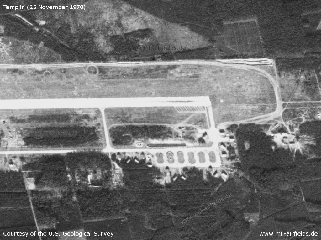
Enlargement of the eastern part - Also at this end there are 12 lanes, here on the southern side of the runway.
Source: U.S. Geological Survey
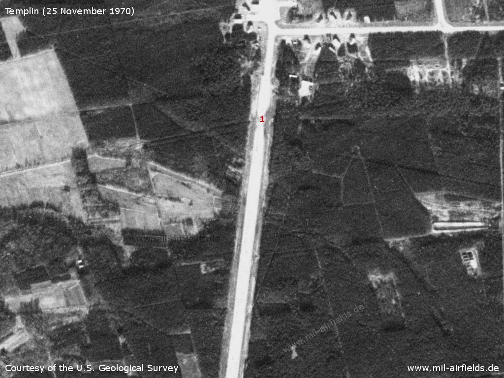
On the west side an auxiliary runway leads approximately to the south. - At mark "1" the railway crosses the runway.
Source: U.S. Geological Survey
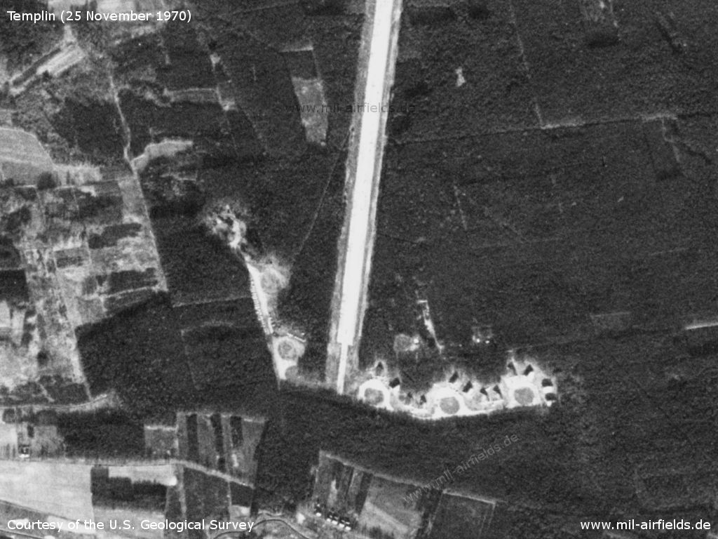
Southern end of the auxiliary runway. - Here there are parking areas for large aircraft, on which later aircraft shelters were arranged.
Source: U.S. Geological Survey
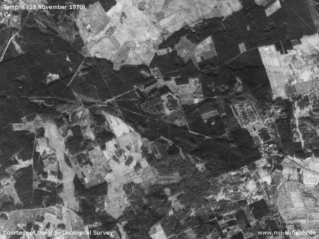
The railway siding from Vogelsang station (top left) to the airfield passes two storage areas.
Source: U.S. Geological Survey
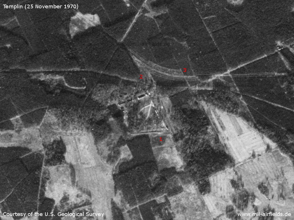
Western storage area near Kurtschlag - 1: Depot, 2: Track; 3: railway siding to the airfield
Source: U.S. Geological Survey
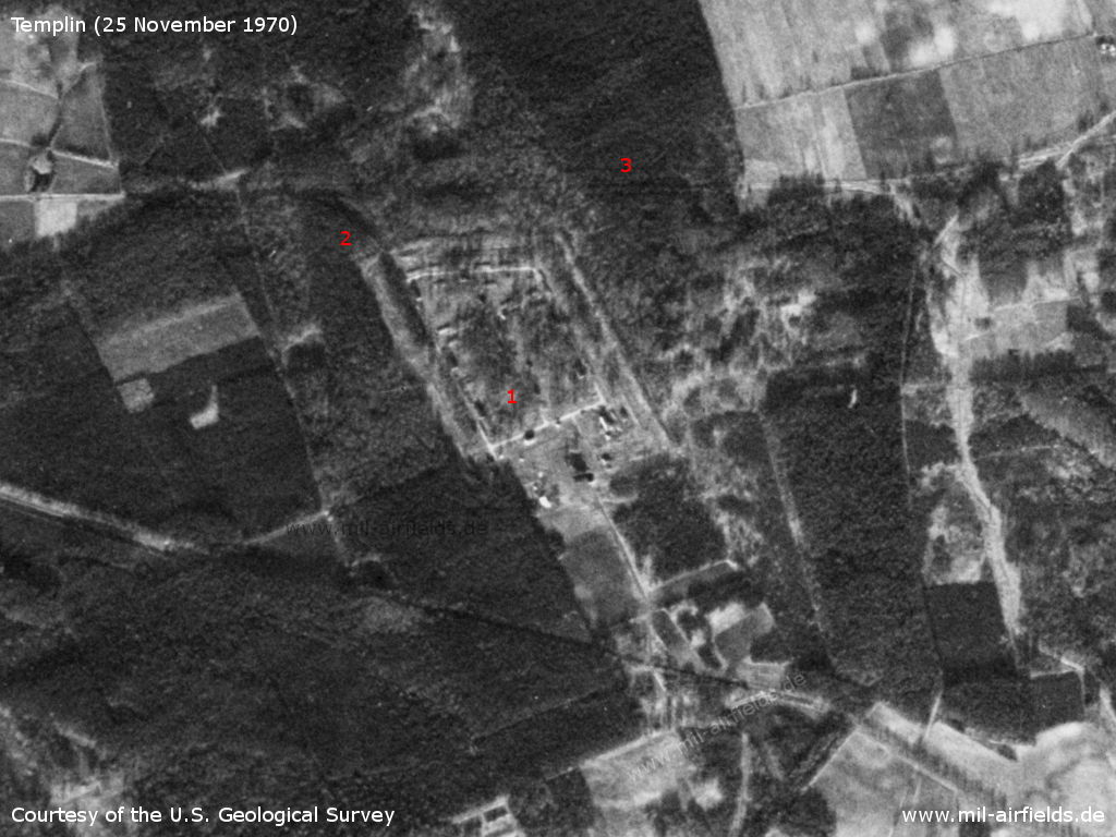
Eastern storage area near Kurtschlag - 1: Depot, 2: Track; 3: railway siding to the airfield
Source: U.S. Geological Survey
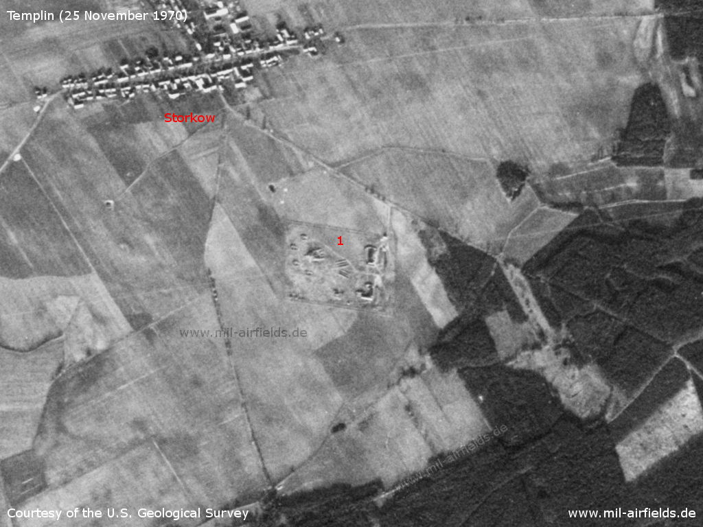
1: SAM site southeast of Storkow
Source: U.S. Geological Survey
Radio communication
Call sign: ASTORIJA (197x)
In the 1980s and early 1990s
Overview
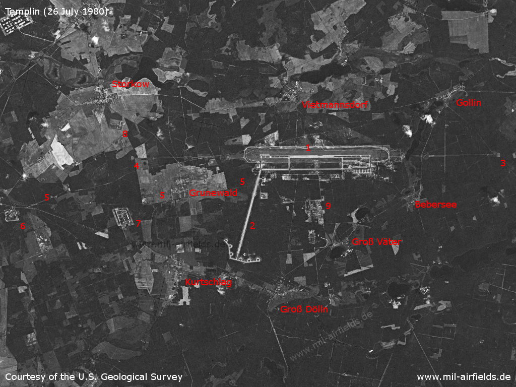
Satellite image from 26 July 1980 - 1: air base; 2: auxiliary runway; 3: outer radio beacon east; 4: outer radio beacon west; 5: railway siding; 6: Storage (fuel?); 7: Storage (ammunition?); 8: SAM site; 9: barracks. Places Bebersee, Gollin, Groß Dölln, Groß Väter, Grunewald, Kurtschlag, Storkow, Vietmannsdorf
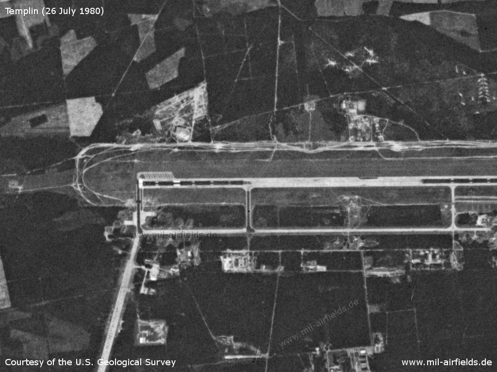
Enlargement: western part
Source: U.S. Geological Survey
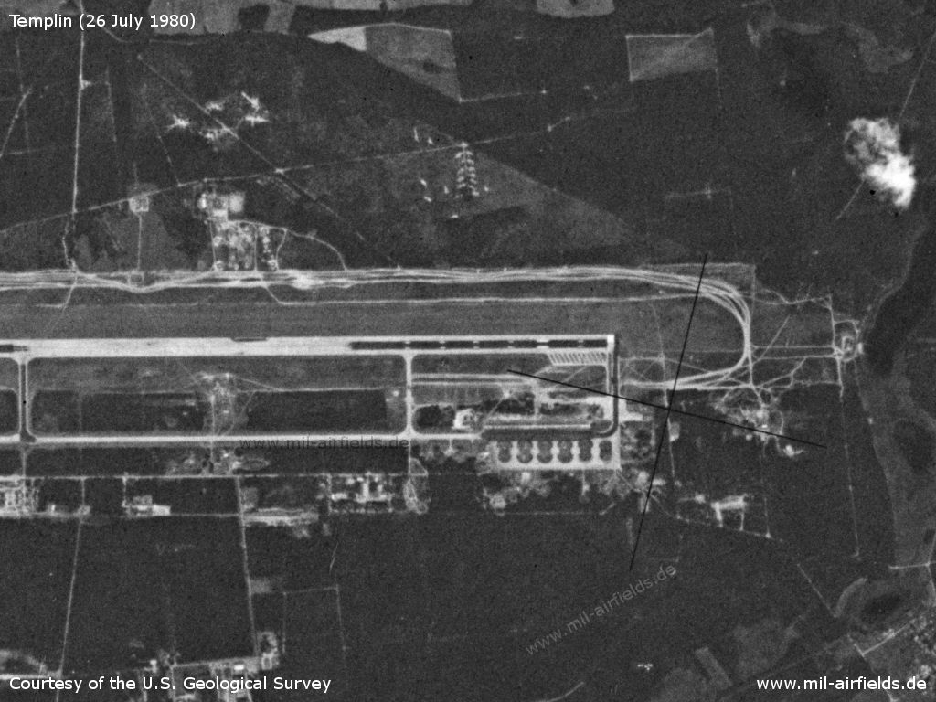
Enlargement: eastern part
Source: U.S. Geological Survey
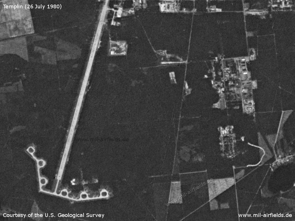
Auxiliary runway
Source: U.S. Geological Survey
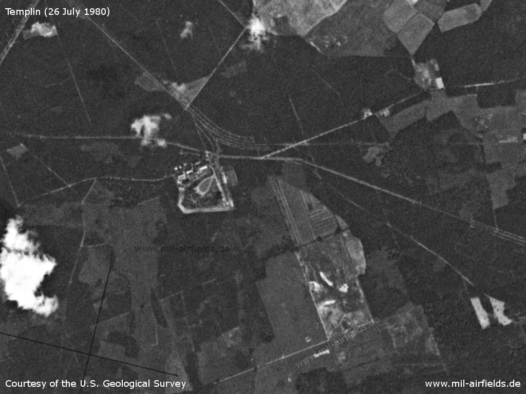
Storage area near Kurtschlag - fuel dump?
Source: U.S. Geological Survey
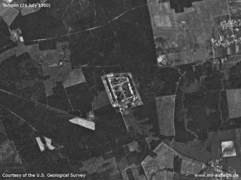
Storage area near Kurtschlag - ammunition dump?
Source: U.S. Geological Survey
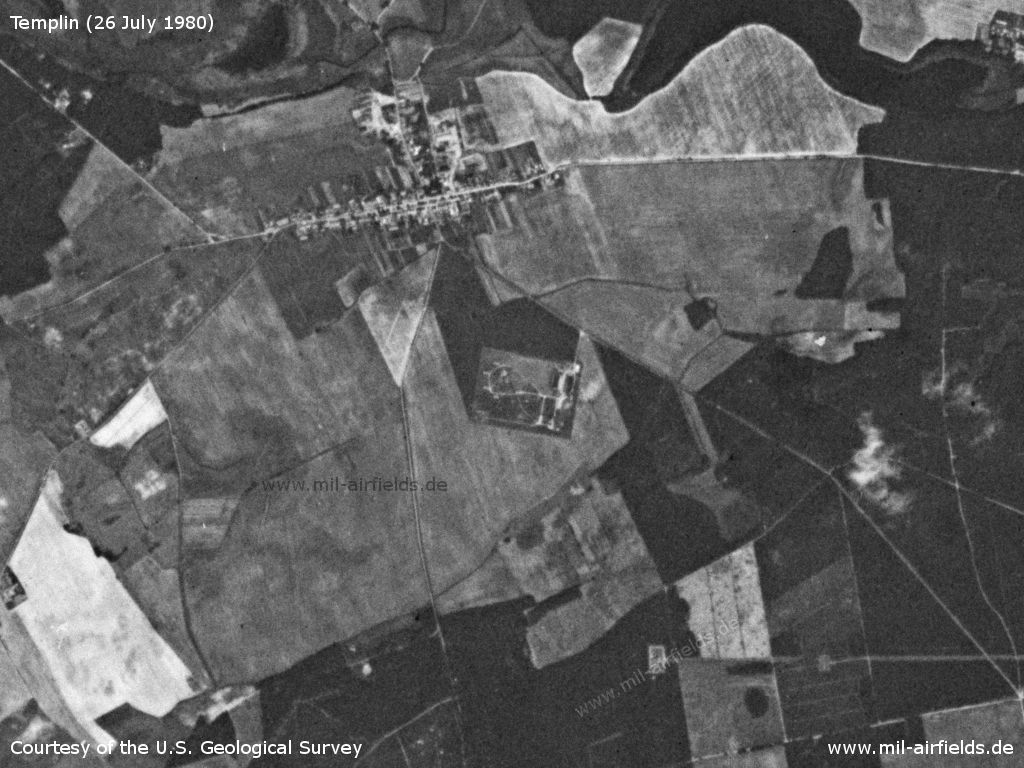
SAM site near Storkow
Source: U.S. Geological Survey
Runways
- 09/27: 3500 m Concrete
- 09/27 Grass
- 01/19: 2600 m
Radio beacons
- LOM 27: 451 "IK"
- LMM 27: 219 "I"
- LOM 09: 451 "PG"
- LMM 09: 219 "P"
Radio communication
Call sign: LEOPARD (199x), see List of call signs
Airspace and procedures
System of landing approach from a straight line
1st (2nd) direction
Take-off with heading 269° (89°), climb to height 2750 m, with left turn to the outer radio beacon at height 3050 m, level flight at height 3050 m, landing approach with right turn and descent to height 2750m
Take-off with heading 269° (89°), climb to height 2750 m, with left turn to the outer radio beacon at height 3050 m, level flight at height 3050 m, landing approach with right turn and descent to height 2750m
Source: Main flight rules HFR DDR-81
Simultaneous flying at the Templin and Finow airbases
At the airfield where flights take place outside the flight graphics, these are to be carried out according to the "two 180° turns" system, with the traffic circuit at both airfields to the north.
The flight altitude for Finow Airbase H = 900 m, for Templin airfield H = 600 m.
After prior coordination between the air traffic control authorities of Finow and Templin airfields (no flight service at Chojna Airbase), flights at Finow airfield are permitted according to the following straight-in approach system:
1st direction
Take-off with GK = 280°, climb to H = 200 m, turn to course GK = 320° and climb to H = 3650 m (distance 40 km), with right turn approach to the outer radio beacon and climb to H = 3950 m. After crossing abeam Groß Dölln, descend to H = 3050 m, approach with right turn and descend to H = 2750 m.
2nd direction
Take-off with GK = 100°, climb to H = 2750 m, with left turn approach to the outer radio beacon and climb to H = 3350 m, after passing the outer radio beacon further climb to H = 3950 m to the point where the turn begins, landing approach with left turn and descent to H = 3650
Source: Main flight rules HFR DDR-81
Units
1990: 20 GwAPIB (Su-17M-3, Su-17M-4, Su-17UM-3); 487 OBVP (Mi-8, Mi-24)
History
- 1988
Unusual observation o a Templin FITTER at the Retzow Firing Range: The plane dropped a bomb. As the bomb fell from the plane, a flare ignited on the rear of the bomb and fell away seperately to the ground. (Source: USMLM 1988) - November 20th, 1988
Observation of low-level flying over the Rossow Range: "Three four-ship of FITTER H from Templin Soviet Airfield were observed operating between 300-500 feet AGL. These aircraft ingressed to the range at between 500-750 feet, but were seen turning after weapons delivery at 300-500 feet and staying low until out of sight." Assessment: "While these observations are the exception and not the rule, they do indicate the Soviets have some pilots trained to operate at altitudes approaching the low-level regime of NATO pilots.
Today
Use
The airfield is closed.
Sources
- https://www.cia.gov/ - CIA: Central Intelligence Agency
- https://www.usgs.gov/ - USGS U.S. Geological Survey
Links
- https://www.kurtschlag.de/damals/die-russen-als-na... - Die Russen als Nachbarn - Vom Leben in den Dörfern beim Flugplatz Groß Dölln 1945-1994
Bibliography
- /USMLM 1988/:
United States Military Liaison Mission: "Unit History 1988"
Airfields in the vicinity
- 072°/17km Temmen: Helipad 3026 (HSLP / HLP 3026)
- 308°/19km Annenwalde: Airfield (Templin 2, Bredereiche)
- 251°/23km Badingen: Helipad 3109 (HSLP / HLP 3109)
- 149°/24km Eberswalde: Helipad 1036 (HSLP / HLP 1036, Eberswalde-Finow)
- 198°/24km Kreuzbruch: Airfield (FRA-4123 Klosterfelde, Helipad 3114, 6102)
- 156°/25km Finow: Air Base (Eberswalde-Finow, Аэродром Финов)