Schwäbisch Hall: Hessental Army Airfield AAF
Hessental, Camp Dolan, Dolan Barracks, Adolf Würth Airport
For historical information only, do not use for navigation or aviation purposes!
| Coordinates | N490706 E0094702 (WGS84) Google Maps |
| Federal state | Baden-Württemberg |
| Location indicator | DBSH (195x), EDOP (196x-199x), EDTY (199x-) |
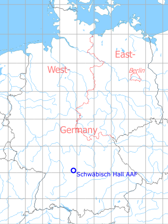
Germany during the Cold War Map
The history of the Cold War airfields: Schwäbisch Hall
Nazi era and World War II: Schwäbisch Hall Air Base
Use
Luftwaffe air base (Fliegerhorst).
Situation
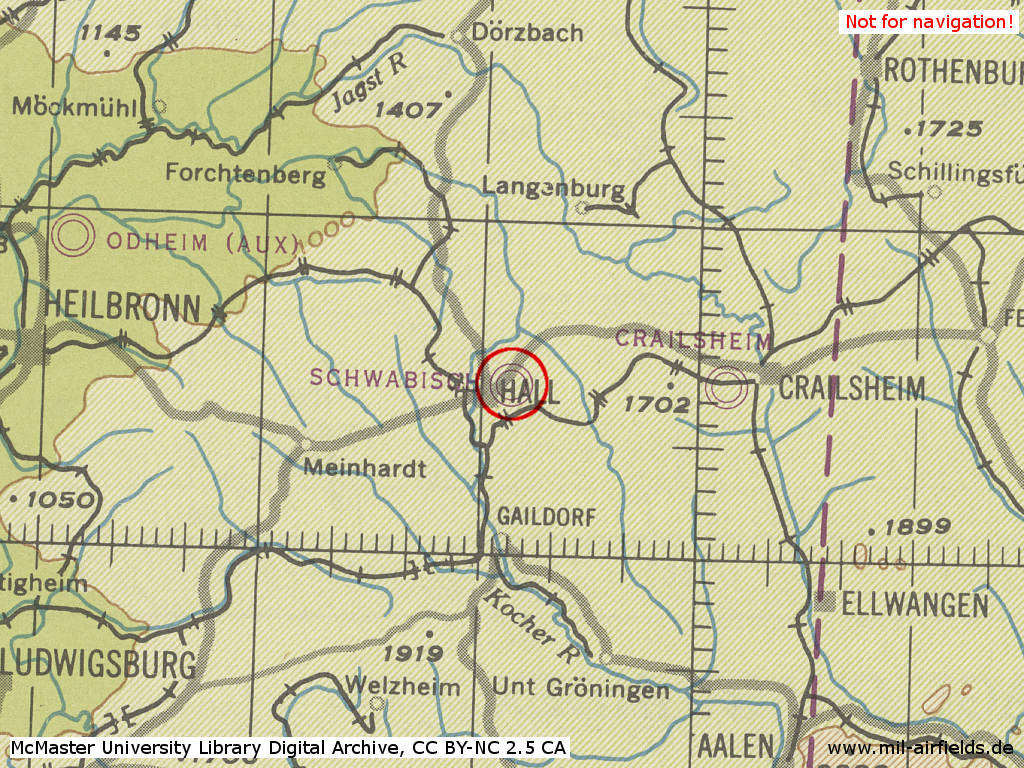
Schwäbisch Hall Air Base in World War II on a US map from 1944
Source: McMaster University Library Digital Archive, License: Creative Commons Attribution-NonCommercial 2.5 CC BY-NC 2.5 CA
During the Cold War: Schwäbisch Hall Army Airfield
Use
US Army airfield.
In the 1970s
Situation
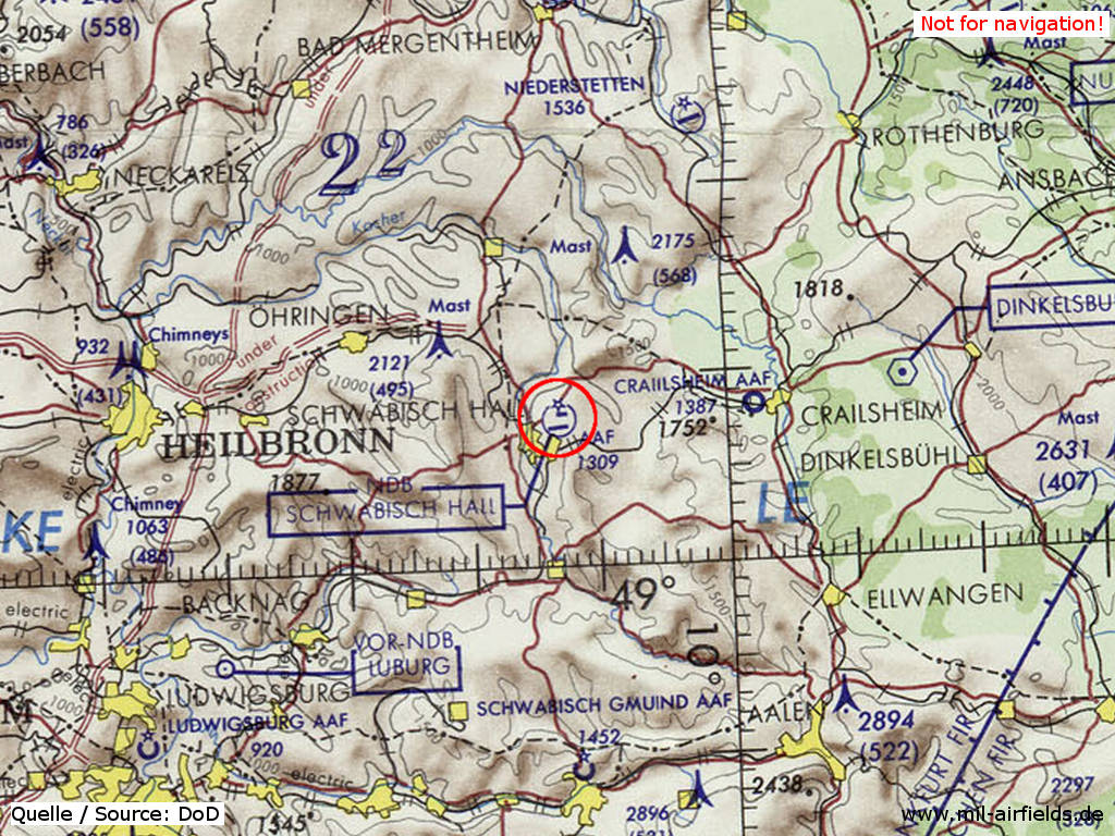
Schwäbisch Hall Hessental Army Airfield (AAF) on a map of the US Department of Defense from 1972
Source: ONC E-2 (1972), Perry-Castañeda Library Map Collection, University of Texas at Austin
Overview
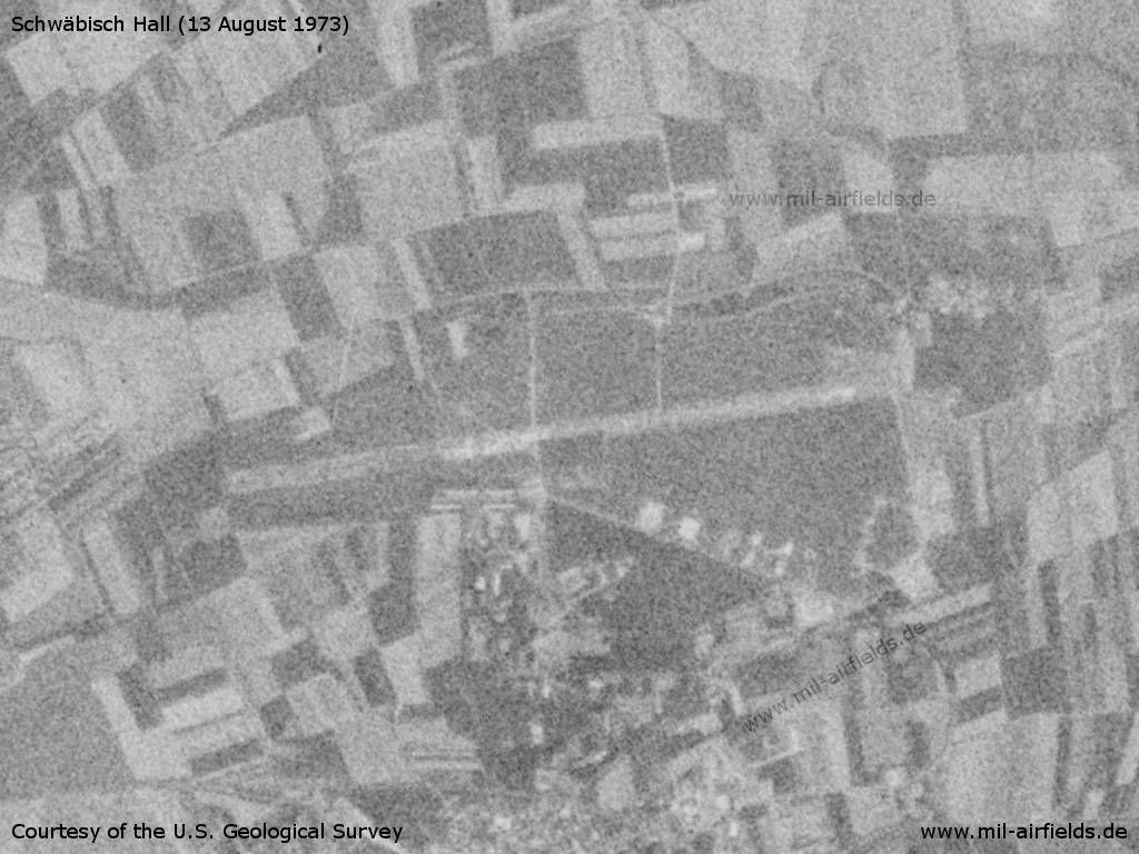
Schwäbisch Hall Army Airfield on a US satellite image from 13 August 1973
Source: U.S. Geological Survey
In the 1980s and early 1990s
Overview
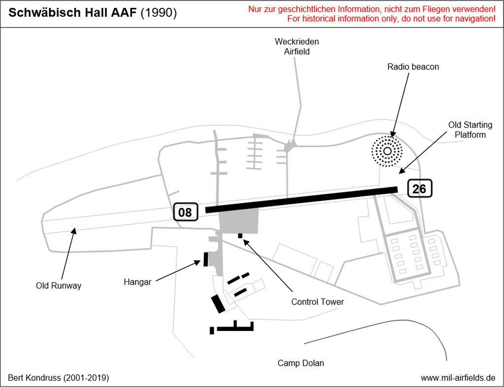
Radio beacons
- NDB: 482 "SWH", at field
Today: Adolf Würth Airport
Use
Airfield.
Images
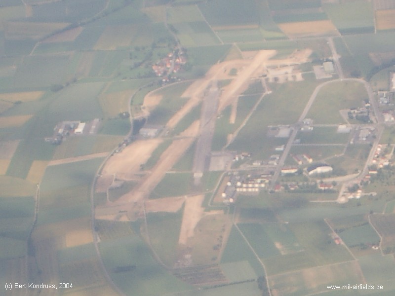
Old runway and construction of the new one in 2004 - Spontaneous snapshot from an airplane approaching Stuttgart :-)
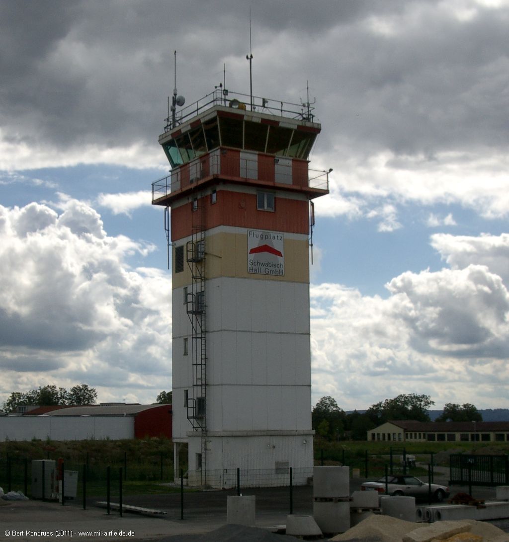
Control tower (2011)
Links
- Die Dolan Barracks 1945-1993
- https://www.edty.de/ - Adolf Würth Airport
Airfields in the vicinity
- 066°/15km Kleinallmerspann: Highway Strip (Autobahn-Notlandeplatz NLP)
- 083°/19km Crailsheim: McKee Barracks Army Heliport AHP
- 084°/19km Crailsheim: Army Airfield AAF (Fliegerhorst Crailsheim)
- 023°/33km Niederstetten: Airfield
- 177°/34km Schwäbisch Gmünd: Army Airfield, Army Heliport (AAF, AHP, Mutlangen)
Categories
Military Airfields GermanyMilitary Airfields in former West GermanyUS Army Airfields and Heliports in GermanyAirfields in Baden-WürttembergRecommended
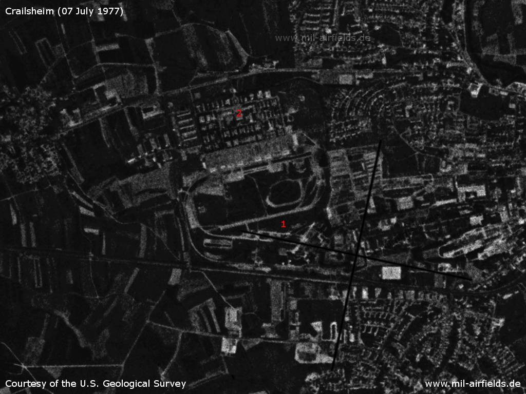
Image credits are shown on the respective target page, click on the preview to open it.
 Follow mil-airfields on Facebook