For historical information only, do not use for navigation or aviation purposes!
| Coordinates | N523754 E0134609 (WGS84) Google Maps |
| Elevation | 263 ft |
| Former East Germany (GDR) | District of Frankfurt/O |
| Federal state | Brandenburg |
| Location indicator | EDBW |
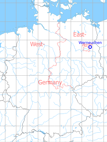
Germany during the Cold War Map
The history of the Cold War airfields: Werneuchen
Location of airfield
The airfield is situated east of Werneuchen.
During World War II
Use
Luftwaffe airbase.
Situation
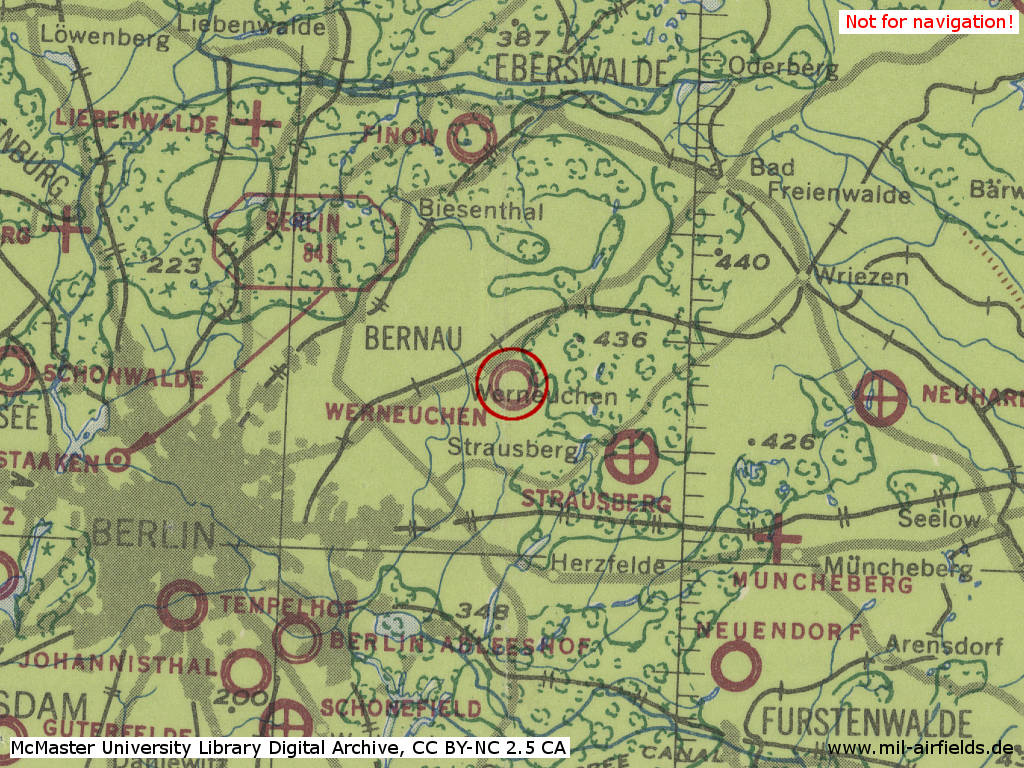
Werneuchen Air Base in World War II on a US map from 1943
Source: McMaster University Library Digital Archive, License: Creative Commons Attribution-NonCommercial 2.5 CC BY-NC 2.5 CA
Overview
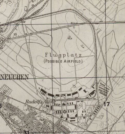
Werneuchen airfield on a US map from 1952
Source: AMS M841 GSGS 4414, Courtesy Harold B. Lee Library, Brigham Young University
During the Cold War
Use
Soviet/russian airbase.
In the 1940s
History
- 1948
Aus einem CIA-Bericht: Auf dem Platz waren 63 Pe-2 abgestellt. Weitere Pe-2 werden auf ungefähr ... geschätzt. Während der Beobachtungszeit gab es fortwährende Starts- und Landungen von Pe-2 einzeln und in 3er-Formationen. 10 flache Güterwagen, die mit Schrott von sowjetischen Flugzeugen beladen waren, standen nahe des Bahnhofs Werneuchen. - Eine andere Quelle berichtete von Trainingsflügen mit 6 Doppelsitzern, zwei Jak-9 und 5 Po-2. (Source: CIA)
In the 1950s
Units in 1954
- Headquarters Soviet bomber division
- 2 Soviet bomber regiments
Source: BND/Bundesarchiv B 206/3033
- 2 Soviet bomber regiments
Source: BND/Bundesarchiv B 206/3033
Railway siding
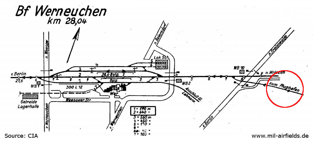
Track diagram of Werneuchen railway station from 1952 - Red marked is the railway siding to the airfield (Flughafen).
Source: CIA / Deutsche Reichsbahn
History
- February-March 1951
No aircraft have been ... on this airfield during the ... (Source: CIA) - ... a runway 50 metres wide, 1600-1800 m in length, is being built on this airfield, running from north-west to south-east. The grass surface of the airfield along this length has already been dug up. There are approx. 180-200 workers employed on the removal of this surface.
- The work which has been carried out by the Brandenburgische Strassenbau Gesellschaft der Bau Union Ost VEB, ... done in three shifts, as ... the areas are under flood-lighting at night.
- The apparatus ... on the top of a large concrete bunker, ... near this airfield, appears to be used, or to have been used for air conditioning purposes.
- November 1953
One runway 2500m x 80m, 25 cm thick. One taxiway 16 m wide north and south of runway. 6 hangars, 1 repair hangar; 32 revetments. Underground fuel dumps north and south of the field, 2000 cubic meters. Ammunition dump northeast of field. The field is temporarily unoccupied. (Source: CIA) - 02 April 1955
36 aircraft Il-28 were counted outside the hangars. - 1959
In case of a war, Werneuchen airfield would have had priority 82 as target for US attacks with nuclear bombs at eastern block airfields (including the Soviet Union and China). Within East Germany ("GDR"), it held the second place at this time, after Groß Dölln (priority 70) und Oranienburg (priority 95). (Source: Targets 1959)
In the 1960s
Situation
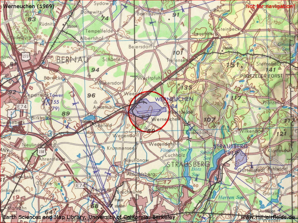
Werneuchen Air Base on a US map from 1969
Source: Earth Sciences and Map Library, University of California, Berkeley
Overview
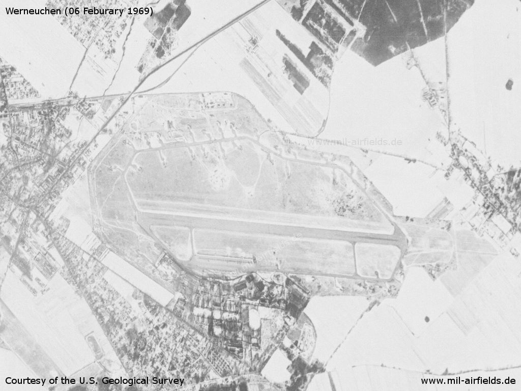
Werneuchen Air Base on a US satellite image from 06 February 1969 - The landscape is snow-covered.
Source: U.S. Geological Survey U.S. Geological Survey
In the 1970s
Situation
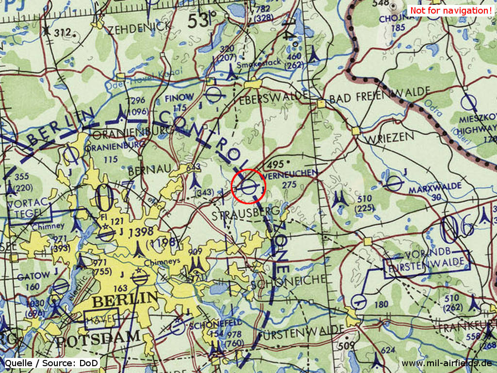
Werneuchen Soviet Air Base on a map of the US Department of Defense from 1972 - The field was located at the border of the Berlin Control Zone (BCZ), which is marked by the blue dotted line here. Since western allied planes could move freely within the BCZ, the field was well reconnaissable for the west from the air.
Source: ONC E-2 (1972), Perry-Castañeda Library Map Collection, University of Texas at Austin
Overview
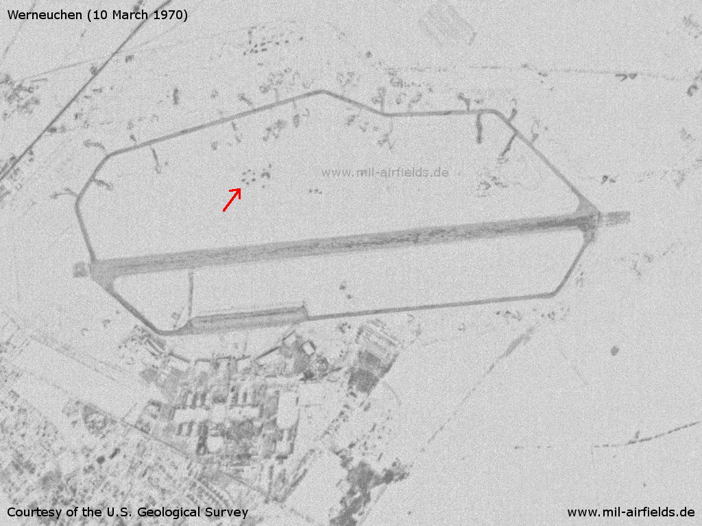
US satellite image from 10 March 1970. - Because of the snow well recognizable: the 6 points on the movement area, which are probably an air defense site (red arrow), The apron in front of the hangars, the aircraft revetments in the south and a taxiway to the runway were not cleared of the snow.
Source: U.S. Geological Survey
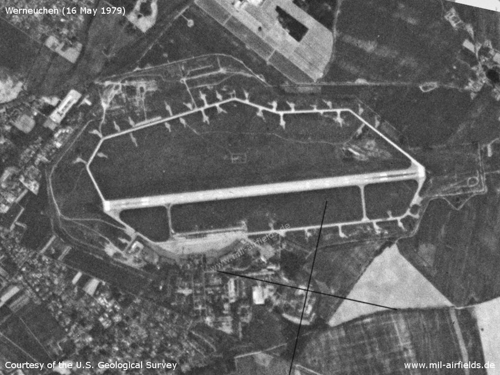
Werneuchen on 16 May 1979
Source: U.S. Geological Survey
In the 1980s and early 1990s
Overview
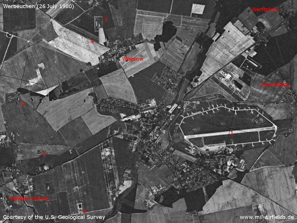
Satellite image from 26 July 1980 - 1: airfield; 2: inner radio beacon west; 3: Löhmen SAM site; 4: Weesow agricultural airfield; 5: radio transmission station of the GDR press agency ADN; 6: Seefeld agricultural airfield; Places: Hirschfelde, Werftpfuhl
Source: U.S. Geological Survey
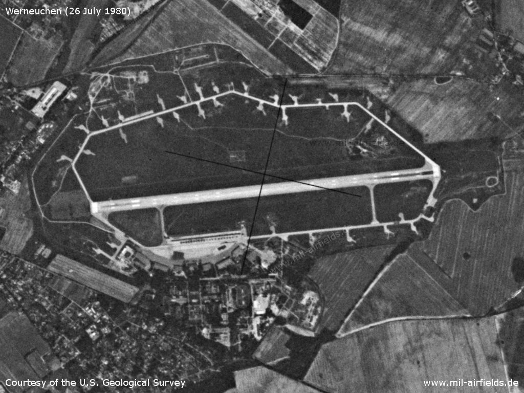
Airfield
Source: U.S. Geological Survey
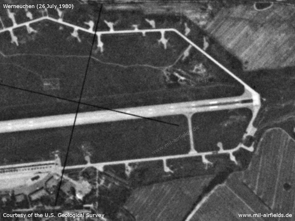
Northwestern part
Source: U.S. Geological Survey
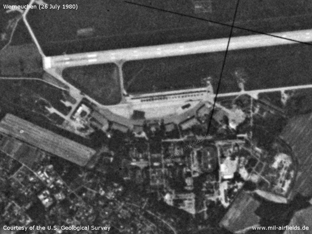
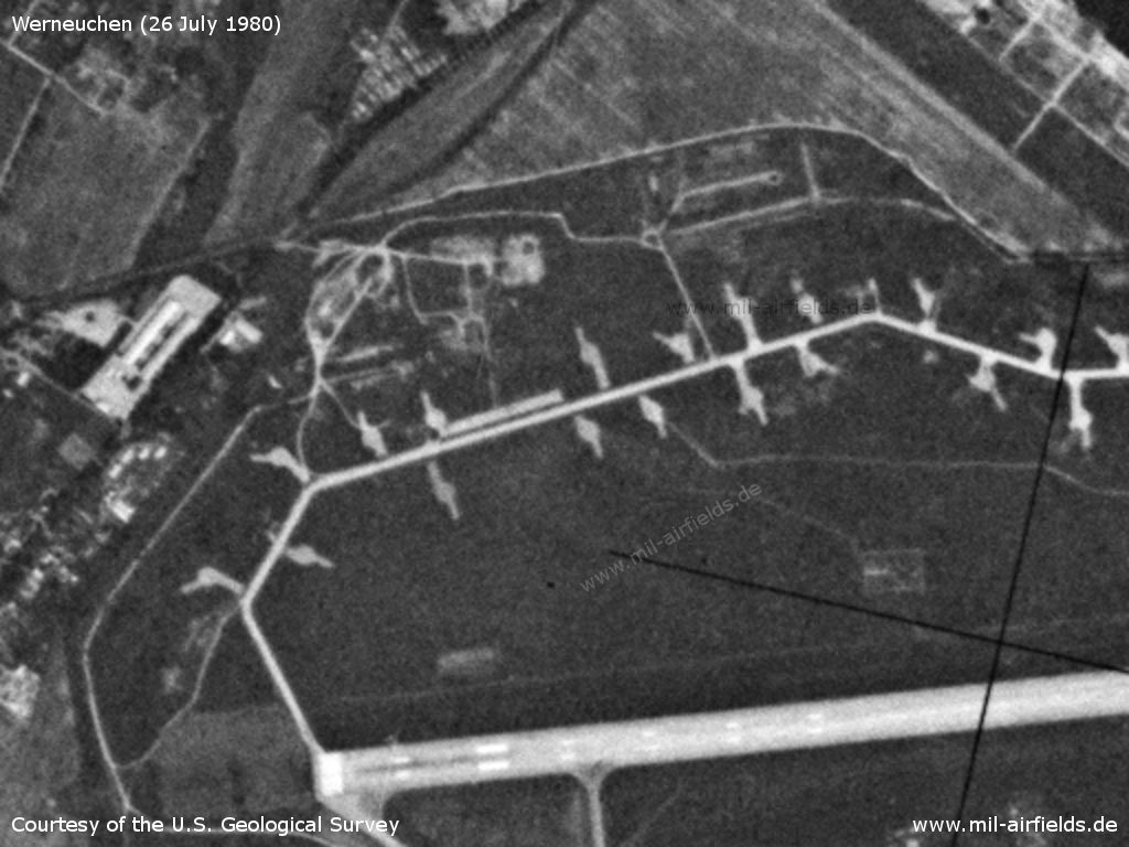
Southwestern part with flight line, hangars and barracks
Source: U.S. Geological Survey
Eastern part
Source: U.S. Geological Survey
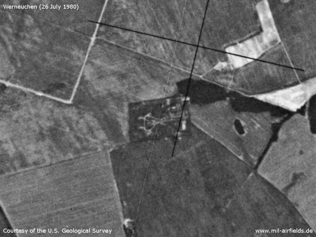
Surface-to-air missile (SAM) site about 1 km northeast of Löhme
Source: U.S. Geological Survey
Runways
- 08/26: 2500 m
Radio beacons
- LOM 26: 318 "AG"
- LMM 26: 654 "A"
- LOM 08: 318 "PB"
- LMM 08: 654 "P"
Radio communication
The russian radio call sign for the airfield was LAGERNI ("Camp", original notation in Cyrillic: ЛАГЕРНЫЙ).
Units
1990: 931 ORAP (MiG-25RB, MiG-25RU, MiG-25BM)
Today
Use
General aviation (EDBW).
Sources
- https://www.cia.gov/ - CIA: Central Intelligence Agency
- https://www.usgs.gov/ - USGS: U.S. Geological Survey
Links
- http://nsarchive.gwu.edu/nukevault/ebb538-Cold-War... - The National Security Archive: U.S. Cold War Nuclear Target Lists Declassified for First Time - National Security Archive Electronic Briefing Book No. 538, Edited by William Burr (2015-12-22)
Airfields in the vicinity
- 242°/10km Blumberg: Agricultural Airfield
- 311°/10km Albertshof: Airfield
- 120°/11km Strausberg: Airfield
- 222°/11km Hönow: Agricultural Airfield
Categories
Military Airfields GermanyMilitary Airfields in former East GermanyAirfields of the Soviet Forces in GermanyRecommended
Image credits are shown on the respective target page, click on the preview to open it.
 Follow mil-airfields on Facebook