For historical information only, do not use for navigation or aviation purposes!
| Coordinates | N525044 E0140423 (WGS84) Google Maps |
| Former East Germany (GDR) | District of Frankfurt/O |
| Federal state | Brandenburg |
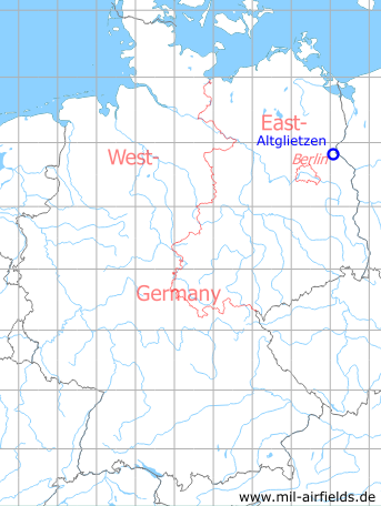
Germany during the Cold War Map
The history of the Cold War airfields: Altglietzen
Location of airfield
2 km northwest of Altglietzen, 1.5 km northeast of Neuenhagen, 3.5 km west of the Oder river and the border with Poland.
During the Cold War
Use
Glider airfield of the former East German pre-military organization Gesellschaft für Sport und Technik (GST). In 1979 Altglietzen was closed, like numerous other GST fields.
In the 1960s
Overview
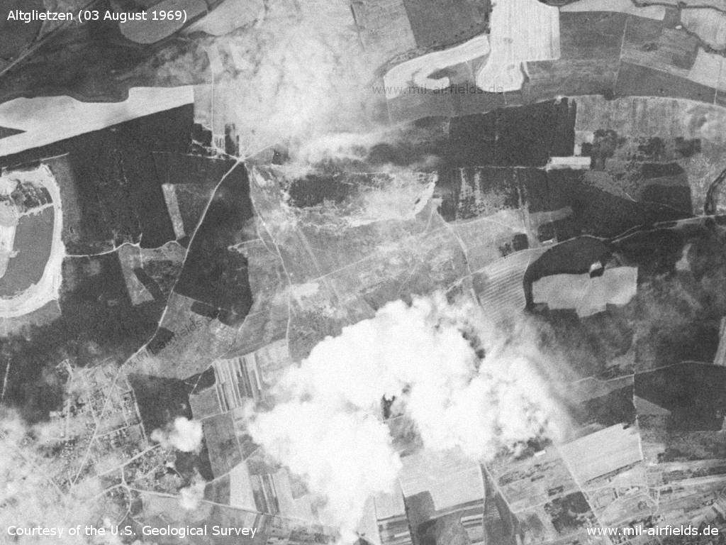
Altglietzen airfield on Sunday, 03 August 1969 - South of the field is a cloud.
Source: U.S. Geological Survey
In the 1970s
Use
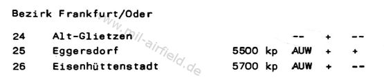
Altglietzen in the "Directory of civil airfields of the German Democratic Republic" from 1977. - Two years before the closure, the field is still listed. The "+" indicates gliding operations. The first "--" means: no powered flight operation, the second "--": no parachute landing field.
Source: VFR-Handbuch für den Agrarflug der DDR, Restricted
Overview
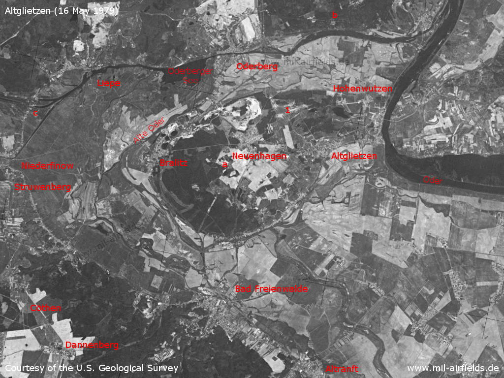
Altglietzen and surroundings on a US satellite image from 16 May 1979 - 1: airfield. Other facilities: a: Vehicle reserve dump 2 Neuenhagen (KfzRL-2); b: Fuel and lubricant dump 22 Hohensaaten (TSL-22), c: Niederfinow ship lift. Other places: Altranft, Bad Freienwalde, Bralitz, Cöthen, Dannenberg, Hohenwutzen, Liepe, Oderberg, Struwenberg. Waters: Alte Oder, Oder, Oderberger See.
Source: U.S. Geological Survey
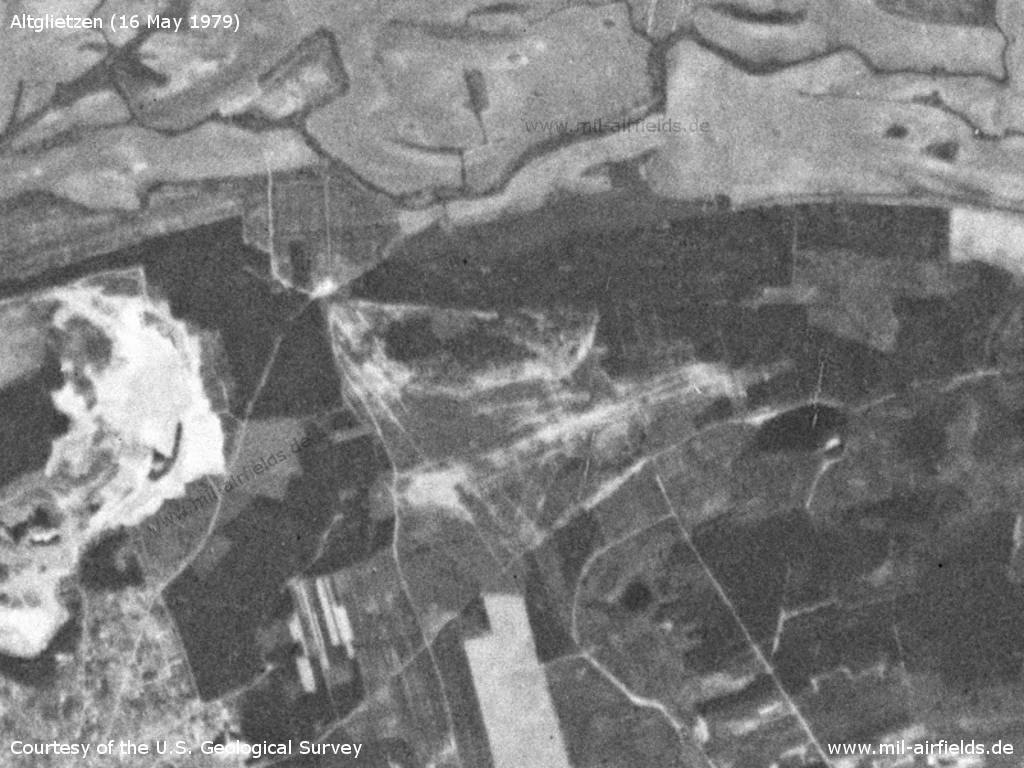
The airfield in the year of closure - The narrow conditions and the sandy ground of the field can be imagined.
Source: U.S. Geological Survey
In the 1980s and early 1990s
Overview
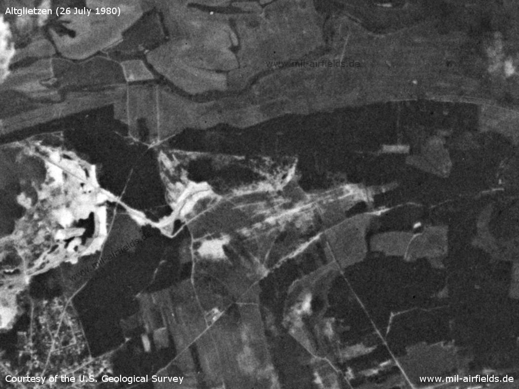
Saturday 26.07.1980, about one year after the closure - From the gravel pit west of the field, a path has been built leading to the north of the former airfield.
Source: U.S. Geological Survey
Today
Use
Closed.
Airfields in the vicinity
Recommended
Image credits are shown on the respective target page, click on the preview to open it.
 Follow mil-airfields on Facebook