Toggle navigation
Military Airfield Directory
Cold War Airfields
Home
Air Bases
Radio beacons
Charts
Topics
Documents
Deutsch
←
Burg Stargard
: Agricultural Airfield, Helipad 3336 (HSLP / HLP 3336, Lindenhof)
Cämmerswalde
: Helipad 1018 (HSLP / HLP 1018) →
Home
Air Bases
Germany
Butzbach
: Army Heliport AHP
Schloss Kaserne
Diese Seite auf Deutsch
For historical information only, do not use for navigation or aviation purposes!
Coordinates
N502603 E0084037
(WGS84)
Google Maps
Elevation
640 ft
Location indicator
EDIO
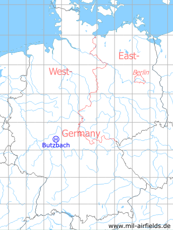
Germany during the Cold War
Map
The history of the Cold War airfields: Butzbach
Location of airfield
The heliport was located on the athletics field.
Usage during the Cold War
US Army helipad.
Use today
Closed. The athletics field is completely overbuilt with new buildings.
Airfields in the vicinity
335°/5km
Kirch-Göns
: Army Airfield (Kirchgons, Ayers)
160°/12km
Friedberg
: Army Airfield AAF (Army Airfield AAF)
183°/29km
Frankfurt/M
: Bonames Airfield (Maurice Rose Army Airfield AAF, Alter Flugplatz)
Categories
Military Airfields Germany
Military Airfields in former West Germany
US Army Airfields and Heliports in Germany
Diese Seite auf Deutsch
←
Burg Stargard
: Agricultural Airfield, Helipad 3336 (HSLP / HLP 3336, Lindenhof)
Cämmerswalde
: Helipad 1018 (HSLP / HLP 1018) →
Follow mil-airfields on Facebook