Friedberg: Army Airfield AAF
For historical information only, do not use for navigation or aviation purposes!
| Coordinates | N502001 E0084404 (WGS84) Google Maps |
| Elevation | 480 ft |
| Federal state | Hessen (Hesse) |
| Location indicator | EDEV (1990) |
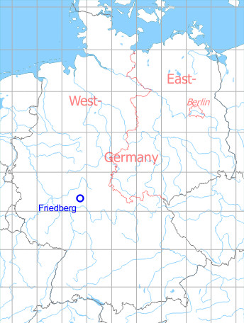
Germany during the Cold War Map
The history of the Cold War airfields: Friedberg
During the Cold War
Use
US Army airfield, later only helipad.
Situation
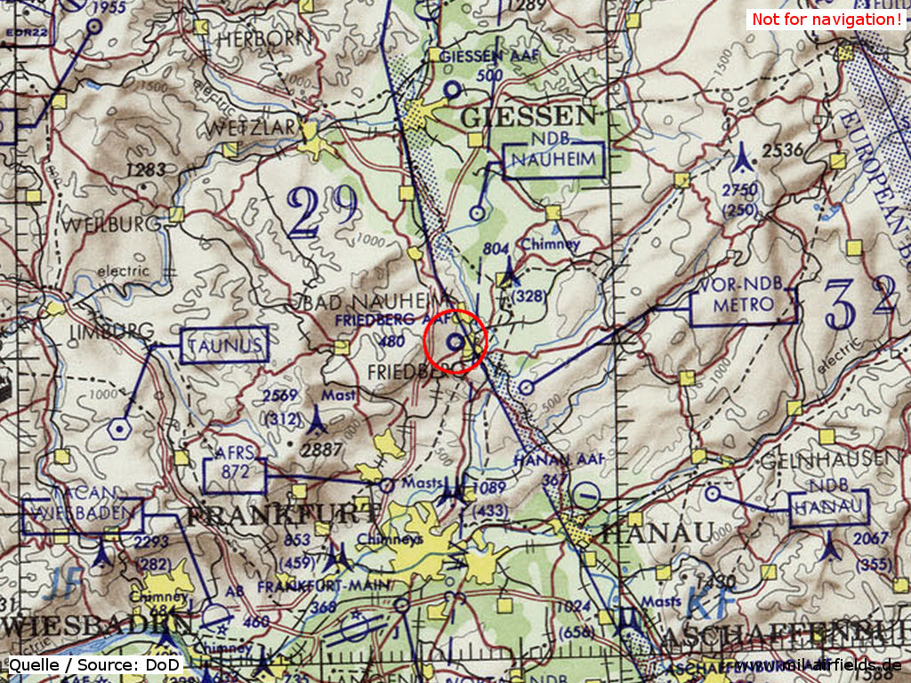
Friedberg Army Airfield (AAF) on a map of the US Department of Defense from 1972
Source: ONC E-2 (1972), Perry-Castañeda Library Map Collection, University of Texas at Austin
Overview
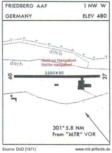
US Army airfield map from 1971
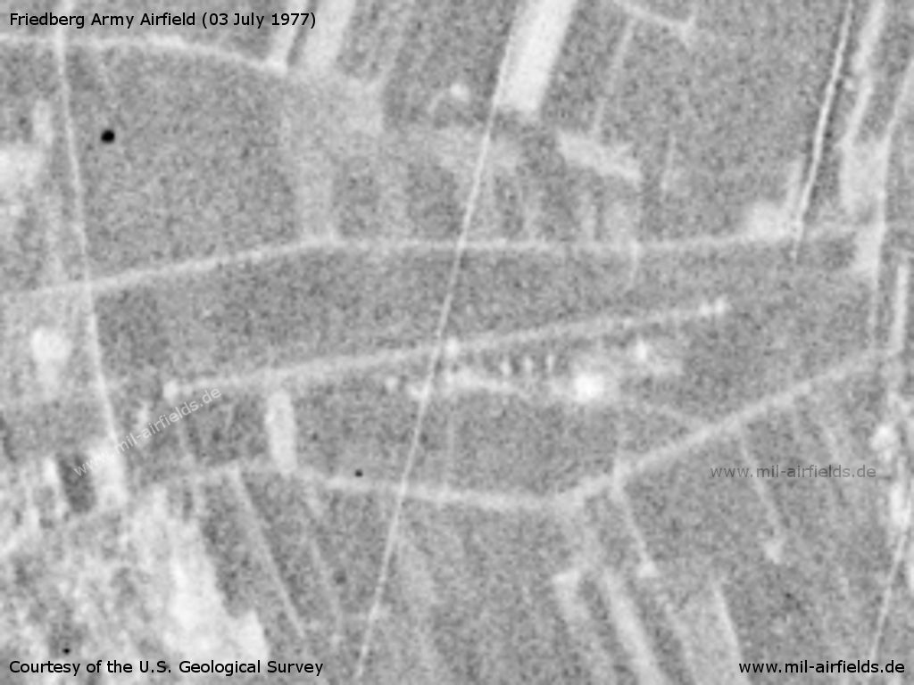
Friedberg Army Airfield AAF on a US satellite image from 03 July 1977
Source: U.S. Geological Survey
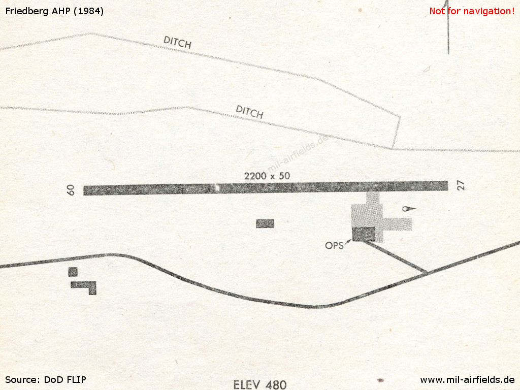
Friedberg airfield in 1984
Runways
Data for the year 1990:
- 09/27: 671 m x 15 m Asphalt
Today
Use
Closed. The runway is mostly demolished and a federal road is crossing the area. There are only a few traces of the former airfield left.
Airfields in the vicinity
- 340°/12km Butzbach: Army Heliport AHP (Schloss Kaserne)
- 338°/17km Kirch-Göns: Army Airfield (Kirchgons, Ayers)
- 197°/18km Frankfurt/M: Bonames Airfield (Maurice Rose Army Airfield AAF, Alter Flugplatz)
- 138°/24km Hanau: Army Air Field AAF (Erlensee, Langendiebach)
- 101°/26km Büdingen: Army Airfield AAF (Budingen)
- 199°/26km Frankfurt/M: Rebstock Airport
- 211°/26km Eschborn: Airfield (Frankfurt-Eschborn, Camp Eschborn Army Heliport)
 Follow mil-airfields on Facebook