For historical information only, do not use for navigation or aviation purposes!
| Coordinates | N492530 E0110659 (WGS84) Google Maps |
| Elevation | 1050 ft |
| Federal state | Bayern (Bavaria) |
| Location indicator | EDIT |
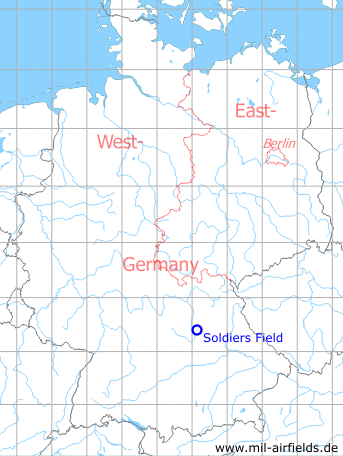
Germany during the Cold War Map
The history of the Cold War airfields: Nuremberg Soldiers Field
Overview
After the Second World War, a US Army airfield called "Soldiers Field Army Airfield" (Soldiers Field AAF) was set up on the so-called Reichsparteitagsgelände (Nazi Party Rally Grounds). The Große Straße, which was paved with granite slabs, was used as runway, while the aircraft parking areas were located southwest on the former Märzfeld. After the opening of Feucht Army Airfield, Soldiers Field was closed. Today the Große Straße is freely accessible, on the former Märzfeld the residential area Langwasser Nordost was built.
During the Cold War
In the 1950s
Overview
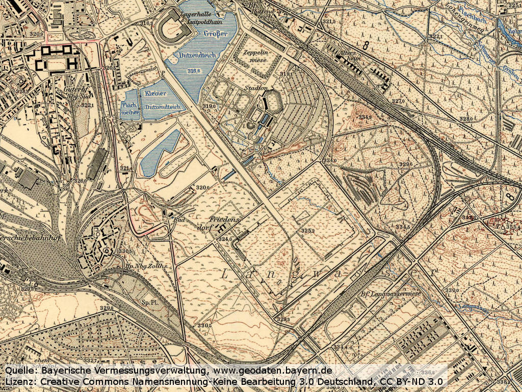
Topographic map (1953/1954) - The Great Road and the former Märzfeld field southeast are well recognizable. The nearby railway station is called "Langwasserwiese". A railway siding leads directly from the south to Grosse Straße runway.
Source: Bayerische Vermessungsverwaltung, www.geodaten.bayern.de
Lizenz: Creative Commons Namensnennung-Keine Bearbeitung 3.0 Deutschland, CC BY-ND 3.0
In the 1960s
Overview
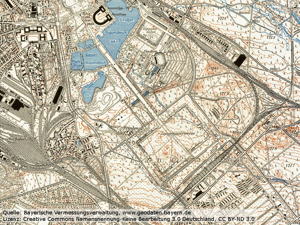
Topographic map (1962)
Source: Bayerische Vermessungsverwaltung, www.geodaten.bayern.de
Lizenz: Creative Commons Namensnennung-Keine Bearbeitung 3.0 Deutschland, CC BY-ND 3.0
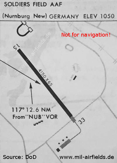
Map (October 1967) - Runway 15/33 has a length of 1,265 m (4,150 feet) and a width of 20 m (65 feet). The parking area is located southeast of today's Karl-Schönleben-Strasse on the former Märzfeld.
Source: US DoD
Runways
- 15/33: 1265 m (4150 ft) x 20 m (65 ft) Marble
Radio communication
Radio 122.1
Airspace and procedures
Operating times: Monday till Friday 0600Z - 1700Z, Saturday 0600Z - 1100Z; other times unattended.
Obstacles
- Unlighted towers, 460 m (1500 ft) off southeast end of runway.
- Unlighted poles, 15 m (50 ft) high, along northeast side of runway.
- Four lighted high towers, 91 m (300 ft) high, 370 m (0.2 NM) east of runway.
- Three unlighted cranes, 60 m (200 ft) high, 900 m (0.5 NM) southwest.
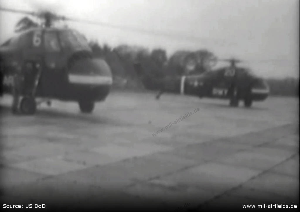
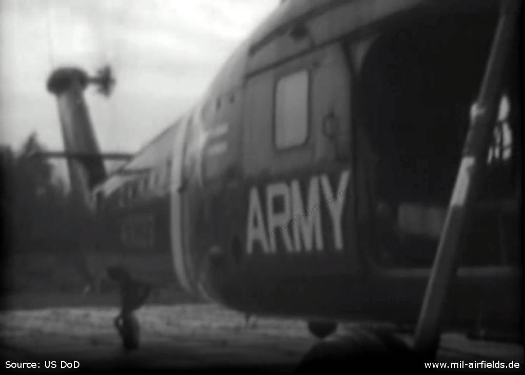
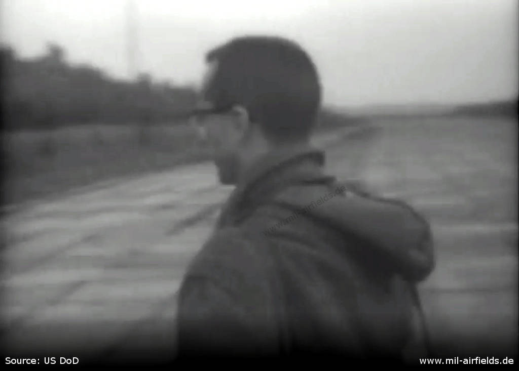
Images from April 1961
Source: Radio-TV tour, Germany. US National Archives. National Archives Identifier: 28518, Local Identifier: 111-LC-45092
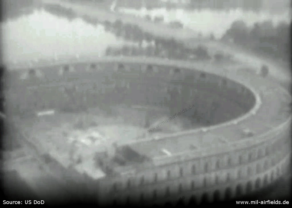
Fly past the congress hall
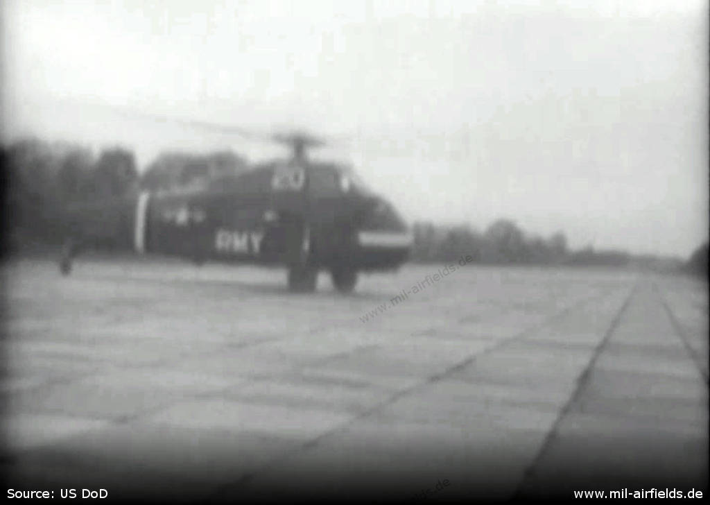
Hubschrauber H-34 at the Soldiers Field
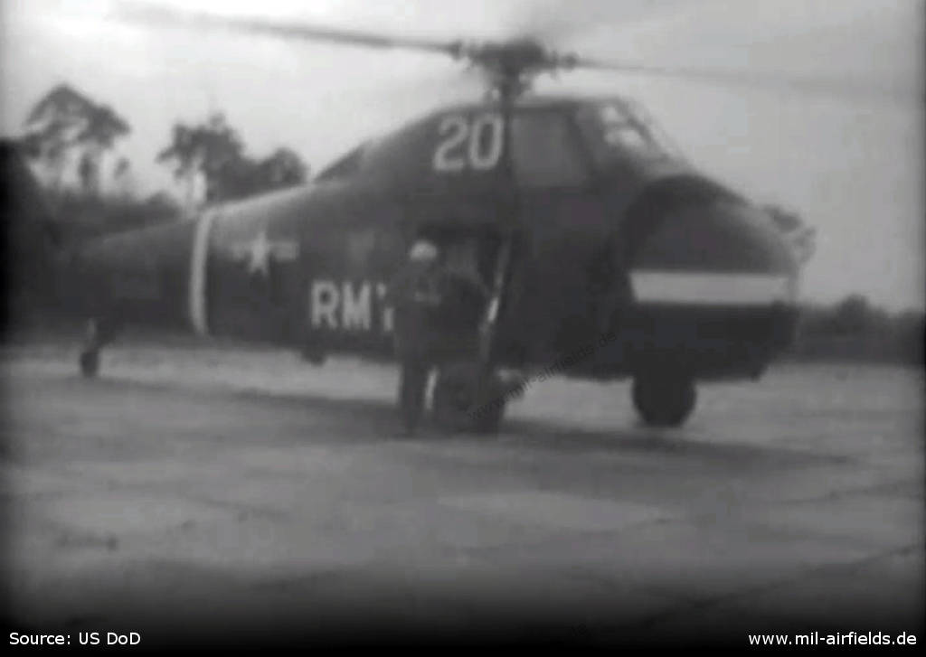
This picture allows a slightly wider view.
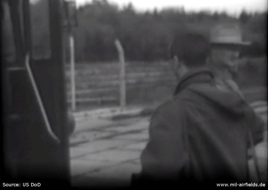
To the right of the bus you can see a fence in the background.
In the 1970s
Situation
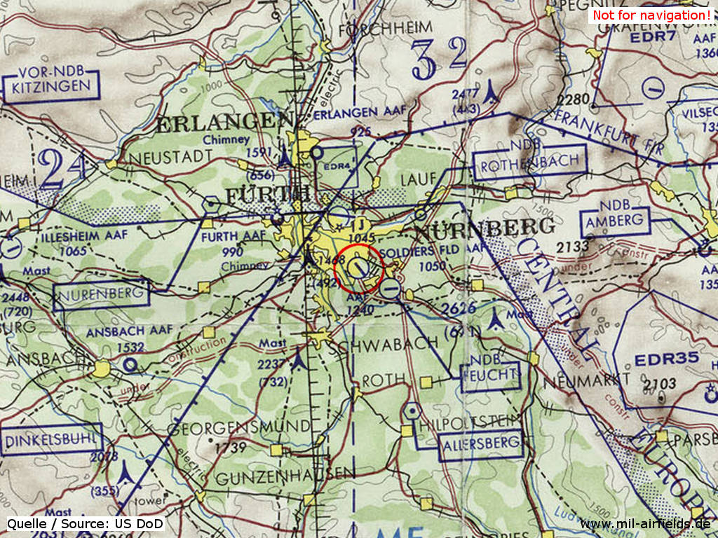
Nürnberg Soldiers Field Army Airfield on a map of the US Department of Defense from 1972 - It is questionable whether the airfield was actually still in operation in 1972.
Source: ONC E-2 (1972), Perry-Castañeda Library Map Collection, University of Texas at Austin
Overview
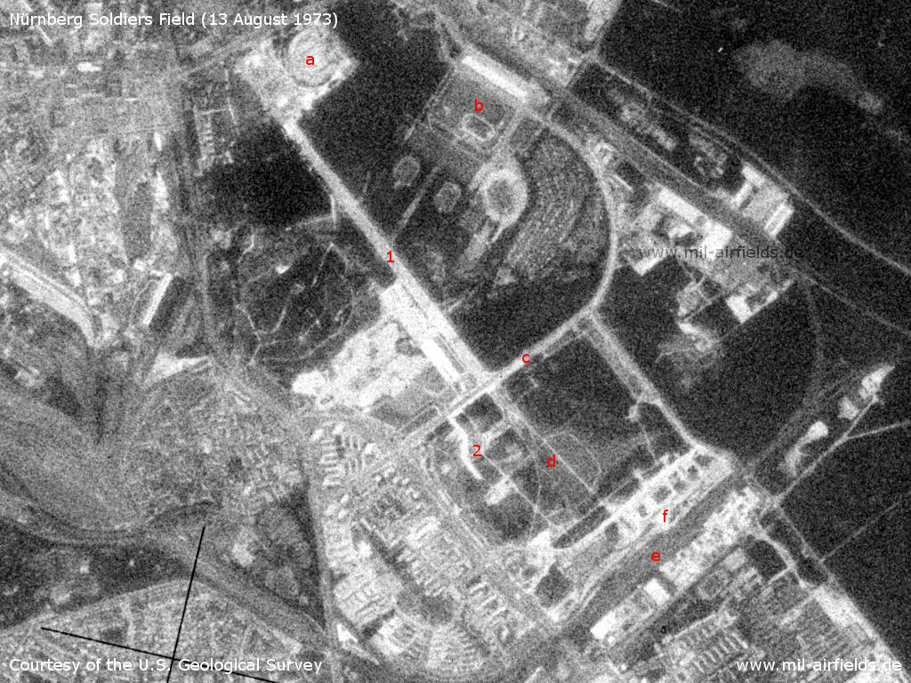
Nürnberg Soldiers Field Army Airfield on a US satellite image from 13 August 1973. Presumably the airfield was no longer in operation at that time. - 1: Runway or Große Straße road; 2: Parking areas. a: Congress hall; b: Zeppelin field; c: Karl-Schönleben-Str.; d: Märzfeld - the present residential area Langwasser Nordost does not yet exist; e: Langwasser railway station; f: the newly built underground railway depot.
Source: U.S. Geological Survey
Today
Use
Closed.
Situation
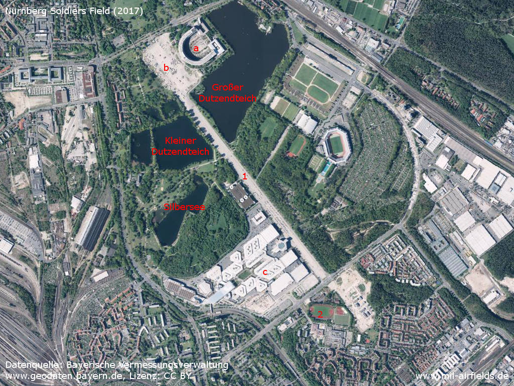
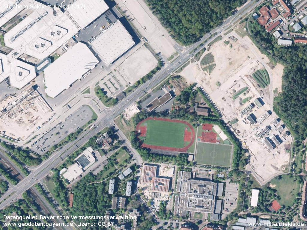
Aerial image (2017) - 1: Große Straße - former runway; 2: former ramp area. a: Congress hall; b: Volksfestplatz; c: Nürnberg Fair. Lakes: Großer Dutzendteich, Kleiner Dutzendteich, Silbersee.
Source: Datenquelle: Bayerische Vermessungsverwaltung www.geodaten.bayern.de, Lizenz: Creative Commons Namensnennung 3.0 Deutschland (CC BY 3.0 DE)
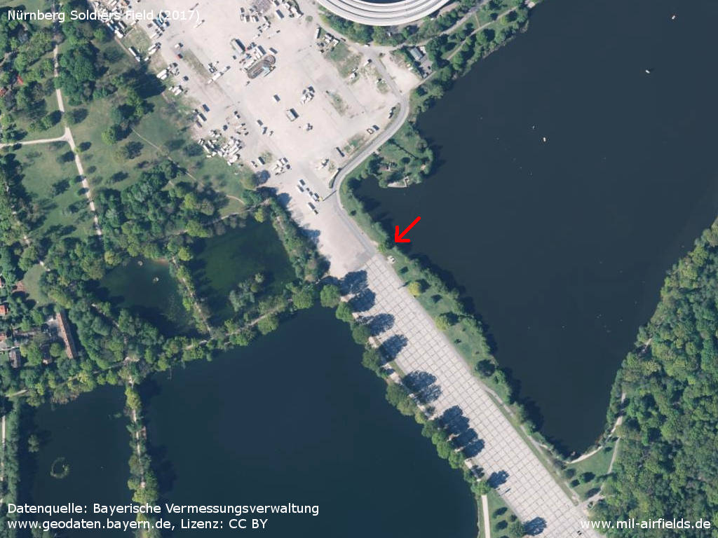
Nordwestern beginning of the runway, between the lakes Großer Dutzendteich and Kleiner Dutzendteich. - The arrow points to the transition to the granite slab covering.
Source: Datenquelle: Bayerische Vermessungsverwaltung www.geodaten.bayern.de, Lizenz: Creative Commons Namensnennung 3.0 Deutschland (CC BY 3.0 DE)
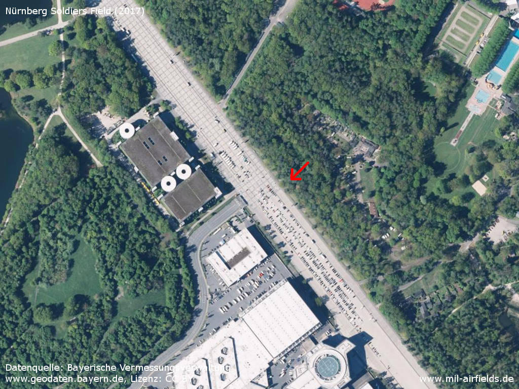
Transition from granite slabs to asphalt pavement
Source: Datenquelle: Bayerische Vermessungsverwaltung www.geodaten.bayern.de, Lizenz: Creative Commons Namensnennung 3.0 Deutschland (CC BY 3.0 DE)
The former parking area for aircraft and helicopters now houses sports facilities and a school.
Source: Datenquelle: Bayerische Vermessungsverwaltung www.geodaten.bayern.de, Lizenz: Creative Commons Namensnennung 3.0 Deutschland (CC BY 3.0 DE)
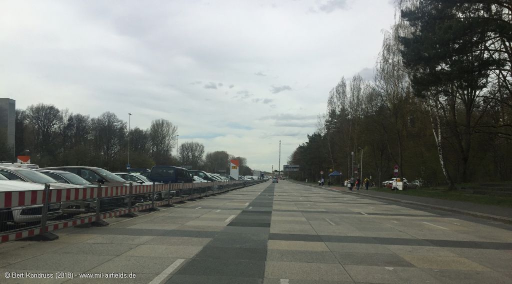
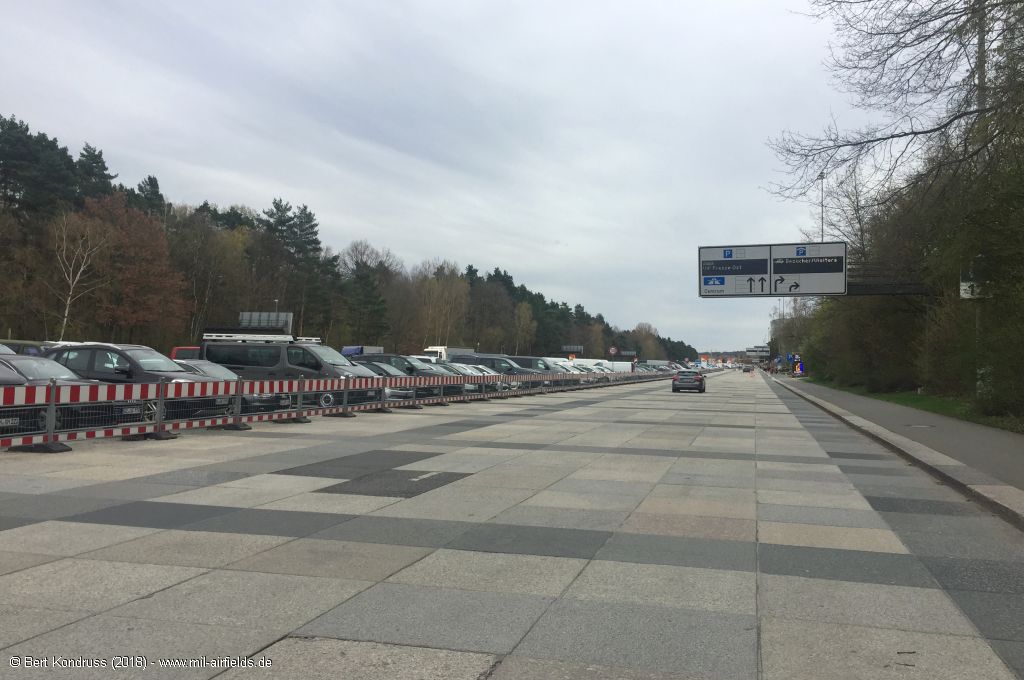
Pictures 2018
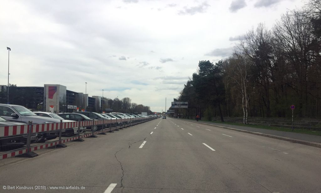
In the southern part, the Große Straße no longer has the original surface.
Further north, however, the granite panels still exist.
Former runway

Area south of Karl-Schönleben-Straße. This was the southern end of the runway. - The parking area was located approximately in the direction of the view (southwest).
Sources
- https://legacy.lib.utexas.edu/maps/ - Perry-Castañeda Library Map Collection
- https://www.archives.gov - National Archives
- https://geoportal.bayern.de/ - Geoportal Bayern
Links
- https://www.usarmygermany.com/Sont.htm?https&&&www... - Soldier's Field Airstrip - 2nd Armored Cavalry Regiment Aviation
- https://cdn.nordbayern.de/region/nuernberg/28-janu... - 28. Januar 1968: Die Landebahn ist geräumt Amerikaner geben der Stadt und der WBG Flugplatzgelände in Langwasser zurück
Airfields in the vicinity
- 135°/6km Feucht: Army Airfield AAF (Feucht Army Airfield AAF)
- 293°/12km Fürth: Dambach Housing Area Helipad
- 298°/13km Fürth: Industrieflughafen Airport (Nuremberg-Fürth Industriehafen Airfield, Fürth Industrie)
- 305°/14km Fürth: Army Airfield AAF (Nürnberg-Fürth Airport, Atzenhof, Monteith Barracks Army Heliport Furth)
- 341°/19km Erlangen: Army Airfield AAF (Ferris Barracks Army Heliport AHP)
Categories
Military Airfields GermanyMilitary Airfields in former West GermanyUS Army Airfields and Heliports in GermanyRecommended
Image credits are shown on the respective target page, click on the preview to open it.
 Follow mil-airfields on Facebook