Bournemouth Hurn Airport
Historical approach and aerodrome charts
For historical information only, do not use for navigation or aviation purposes!
| Coordinates | N504650 W0015022 (WGS84) Google Maps |
Airport
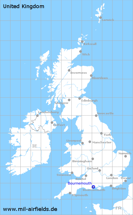
Region:
Dorset
Location Indicator:
GAUA, EGHH
In the 1940s
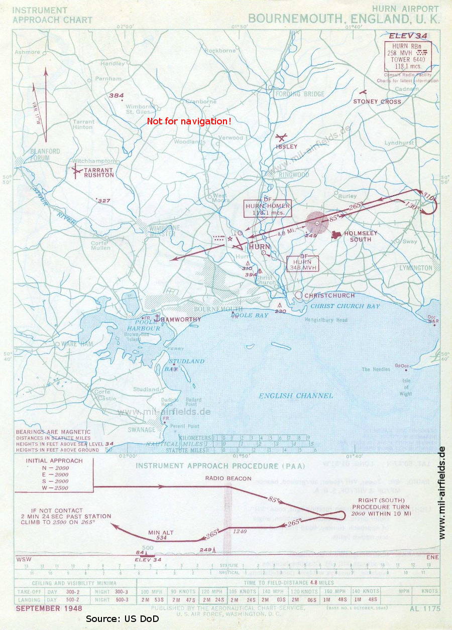
NDB approach (September 1948) - Airfields in the vicinity: Christchurch, RAF Hamworthy seaplane base, Holmsley South, Ibsley, Stoney Cross, Tarrant Rushton (Source: US DoD)
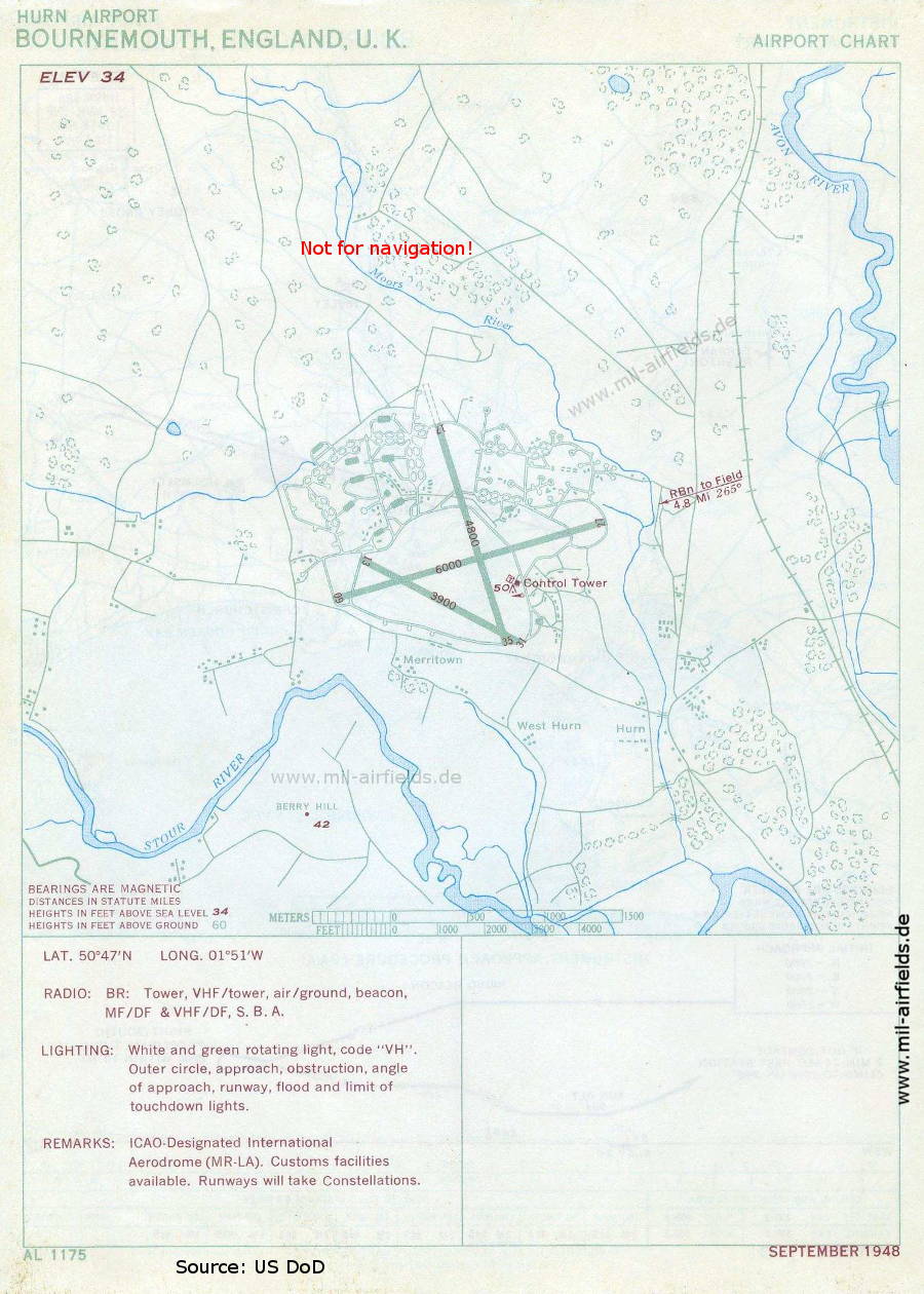
Airport map (September 1948) (Source: US DoD)
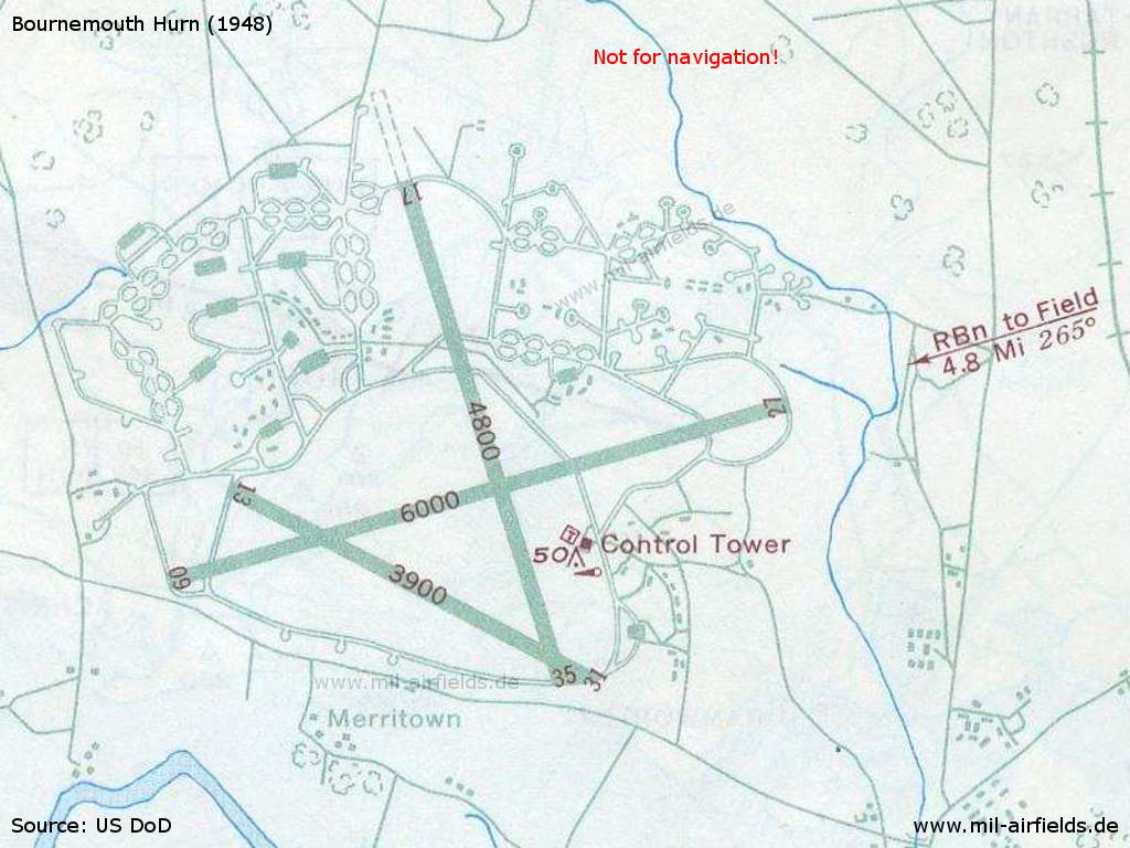
Enlargement - There are three runways - 09/27: length 1829 m (6000 feet), 13/31: length 1189 m (3900 feet), 17/35: length 1463 m (4800 feet). (Source: US DoD)
In the 1950s
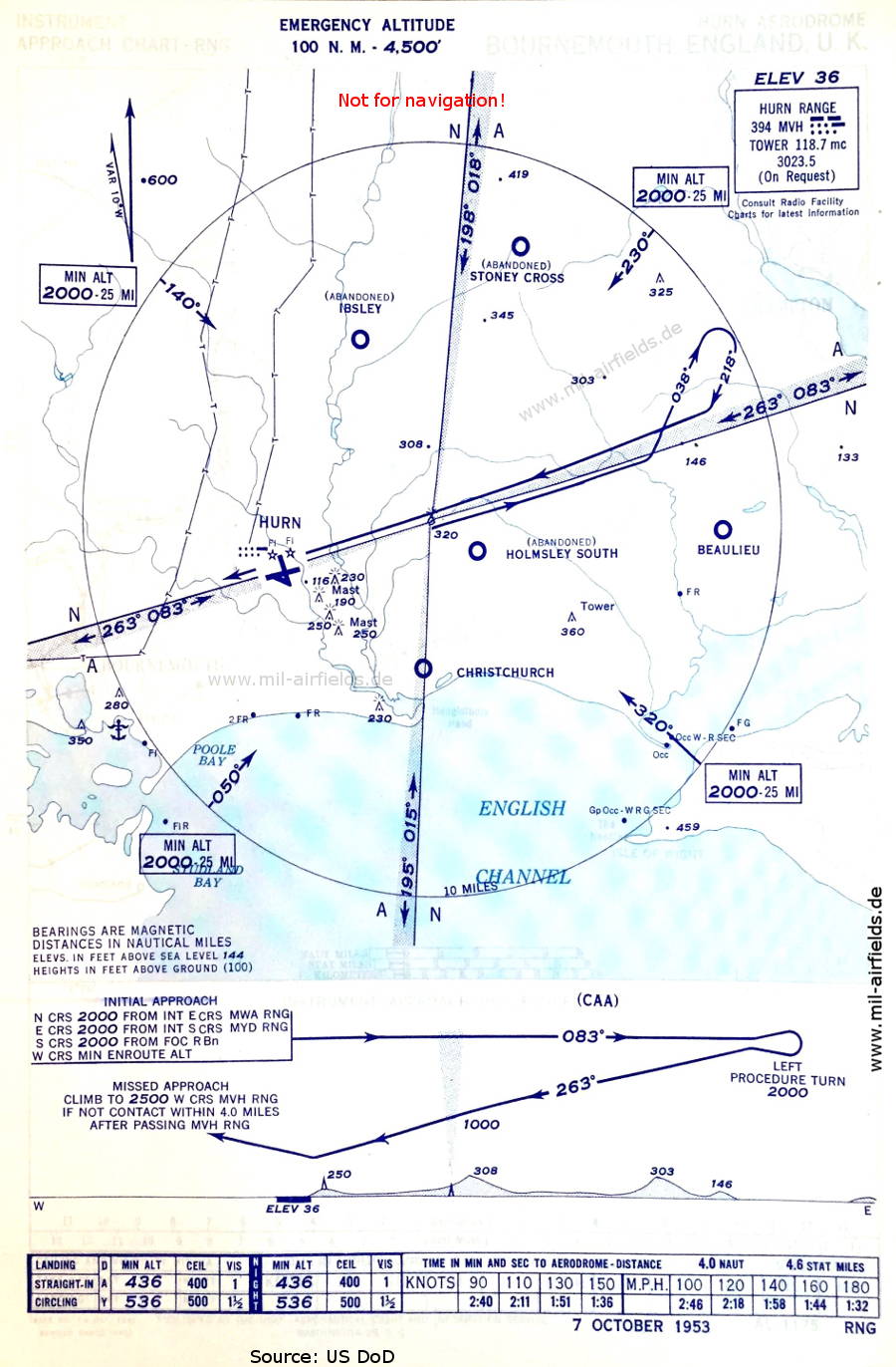
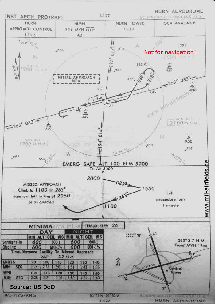
Range approach (October 1953) - Airfields in the vicinity: Beaulieu, Christchurch, Holmsley South, Ibsley, Stoney Cross, (Source: US DoD)
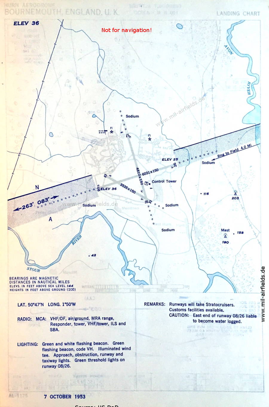
Airport diagram October 1953) - Now the runways are indicated as - 08/26: length 1838 m, width 46 m (6031 feet x 150 feet), 13/31: length 1077 m, width 46 m (3535 feet x 150 feet), 17/35: length 1466 m, width 46 m (4810 feet x 150 feet). The abbreviation SBA means: Standard Beam Approach; (Source: US DoD)
In the 1960s
Range approach runway 26 (October 1960) - Runway 13/31 is closed now. (Source: US DoD)
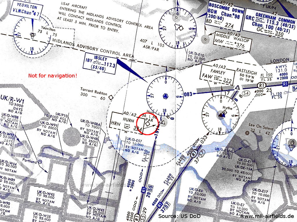
Bournemouth Hurn airport on an enroute chart from 14 November 1963 - The airfield has a precision approach radar (PAR). (Source: US DoD - USAF/USN)
In the 1970s
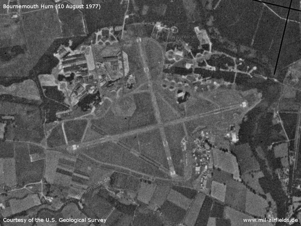
Satellite image from 10 August 1977 (Source: U.S. Geological Survey)
In the 1990s
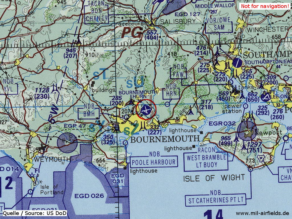
Bournemouth Hurn Airport on a map of the US Department of Defense from 1993 (Source: ONC E-2 (1993), Perry-Castañeda Library Map Collection, University of Texas at Austin)
Index to the objects shown on the maps
Aerodromes:
- Beaulieu, Boscombe Down, Bournemouth Hurn, Christchurch, Greenham Common, RAF Hamworthy Seaplane Base, Holmsley Southm Hythe Seaplane Base, Ibsley, Lee on Solent, Stoney Cross, Tarrant Rushton, Thorney Island, Yeovilton
Airspace:
- Airway R1
- Midlands Advisory Control Area
Radio beacons:
- Boscombe Down NDB "BD", TACAN "BDN"
- Fawley NDB "FAW"
- Greenham Common VOR "GRC", TACAN "GRC", NDB "GC"
- Hurn Range "MVH", NDB "HRN", "MVH"
- Ibsley VOR "IBY"
- Middle Wallop NDB "MW"
- Thorney Island NDB "TI", TACAN "TIS"
- Yeovilton TACAN "VLN"
Air traffic control:
- Hurn Approach Control, Hurn Tower
- London Airways
Source for all maps, if not marked otherwise: US Department of Defense (US DoD)
Recommended
Image credits are shown on the respective target page, click on the preview to open it.
 mil-airfields.de at Facebook