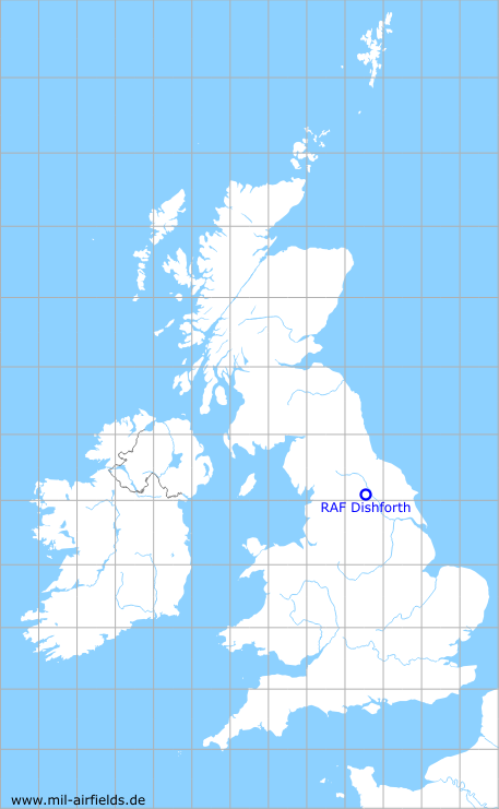
RAF Dishforth
Historical approach and aerodrome charts for free download
For historical information only, do not use for navigation or aviation purposes!
| Coordinates | N540812 W0012510 (WGS84) Google Maps |
| Region | Harrogate, North Yorkshire |
| Location indicator | MWXD, EGXD |
| Operator | Royal Air Force (RAF) |
In the 1950s
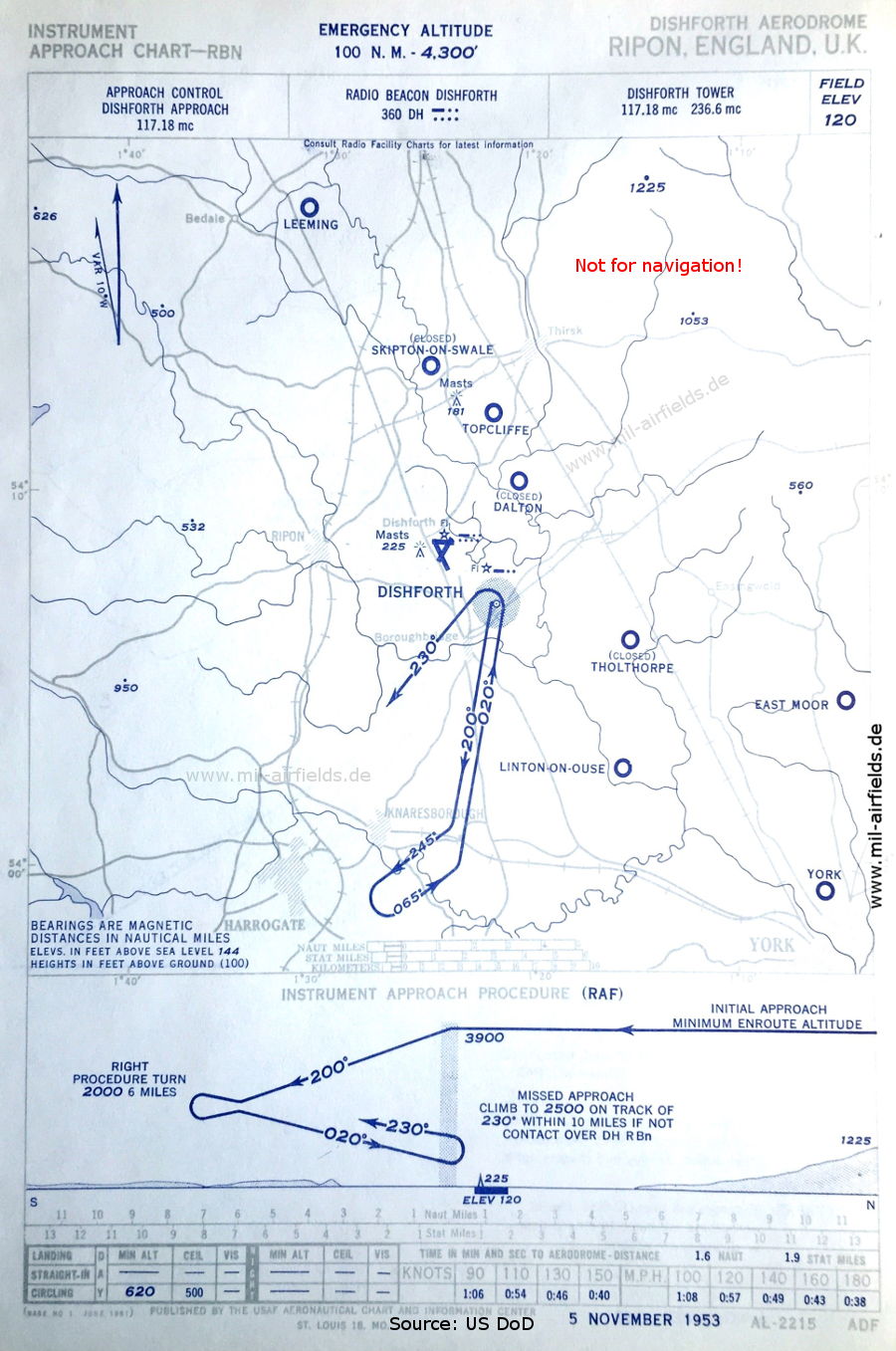
NDB approach (November 1953) - Airfields in the vicinity: Dalton, East Moor, Leeming, Linton-on-Ouse, Skipton-on-Swale, Tholthorpe, Topcliffe, York (Source: US DoD)
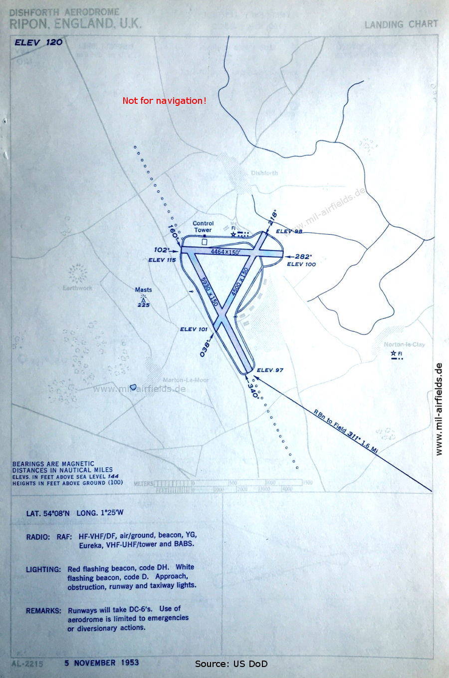
Aerodrome (November 1953) - There are three runways - 038/218: length 1372 m, width 46 m (4500 feet x 150 feet), 102/282: length 1361 m, width 46 m (4464 feet x 150 feet), 160/340: length 1807 m, width 46 m (5930 feet x 150 feet). (Source: US DoD)
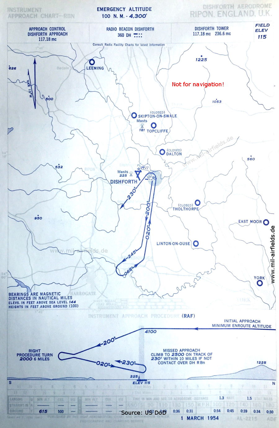
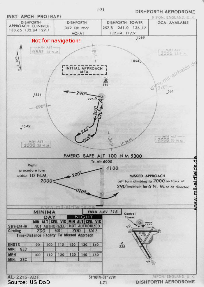
NDB approach (March 1954) - Compared to the 1953 map, the radio beacon is now further north. (Source: US DoD)
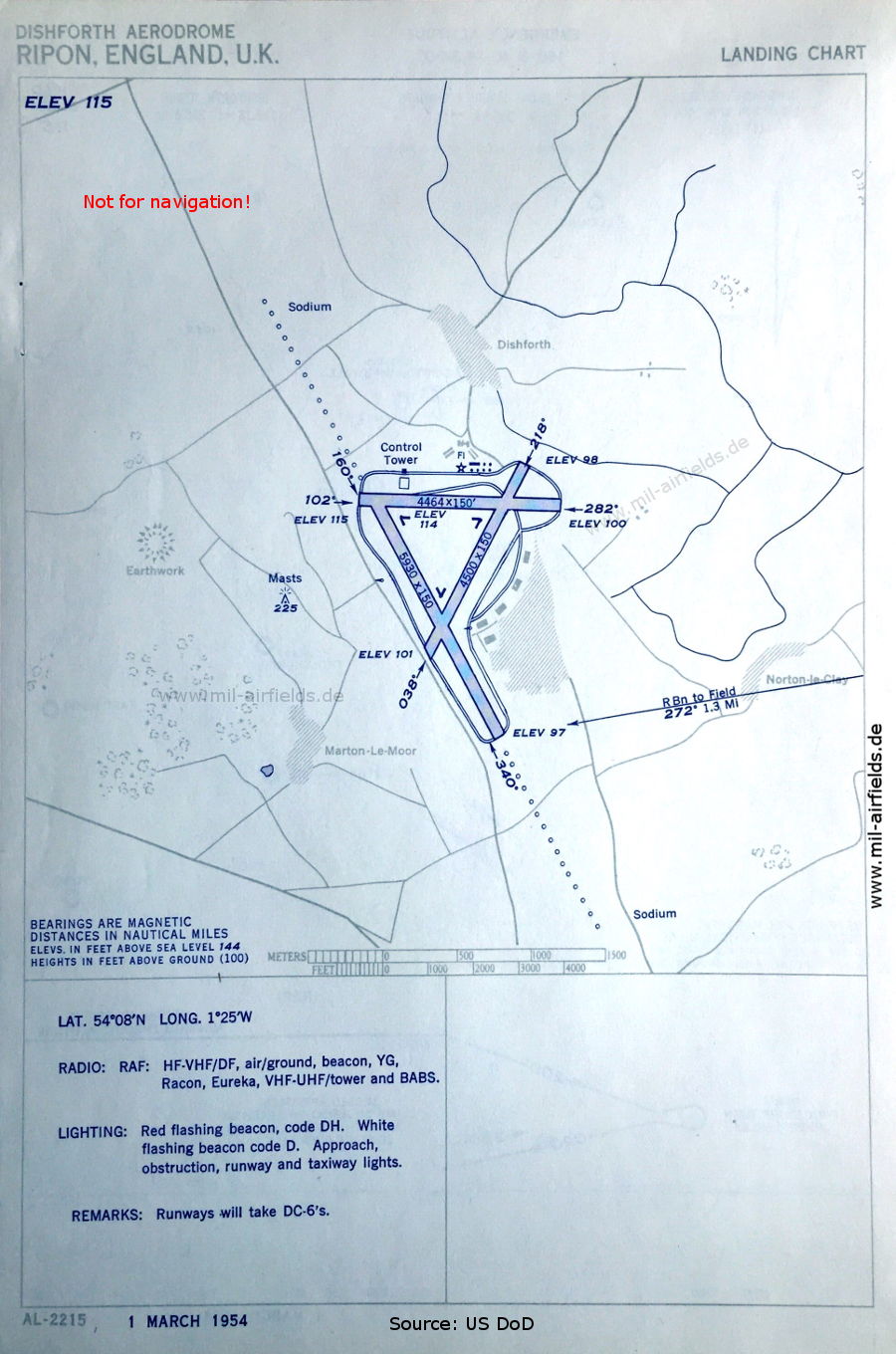
Aerodrome (March 1954) (Source: US DoD)
In the 1960s
NDB approach (October 1960) - Now two runways are shown - 10/28: length 1359 m, width 46 m (4460 feet x 150 feet), 16/34: length 1820 m, width 46 m (5970 feet x 150 feet). (Source: US DoD)
Index to the objects shown on the maps
Aerodromes:
- Dalton, East Moor, Leeming, Linton-on-Ouse, Skipton-on-Swale, Tholthorpe, Topcliffe, York
Radio beacons:
- Dishforth NDB "DH"
Air traffic control
- Dishforth Approach Control, Dishforth Tower
Places:
- Bedale, Boroughbridge, Harrogate, Knaresborough, Marton-le-Moor, Norton-le-Clay, Ripon, Thirsk, York
Source for all maps, if not marked otherwise: US Department of Defense (US DoD)
Recommended
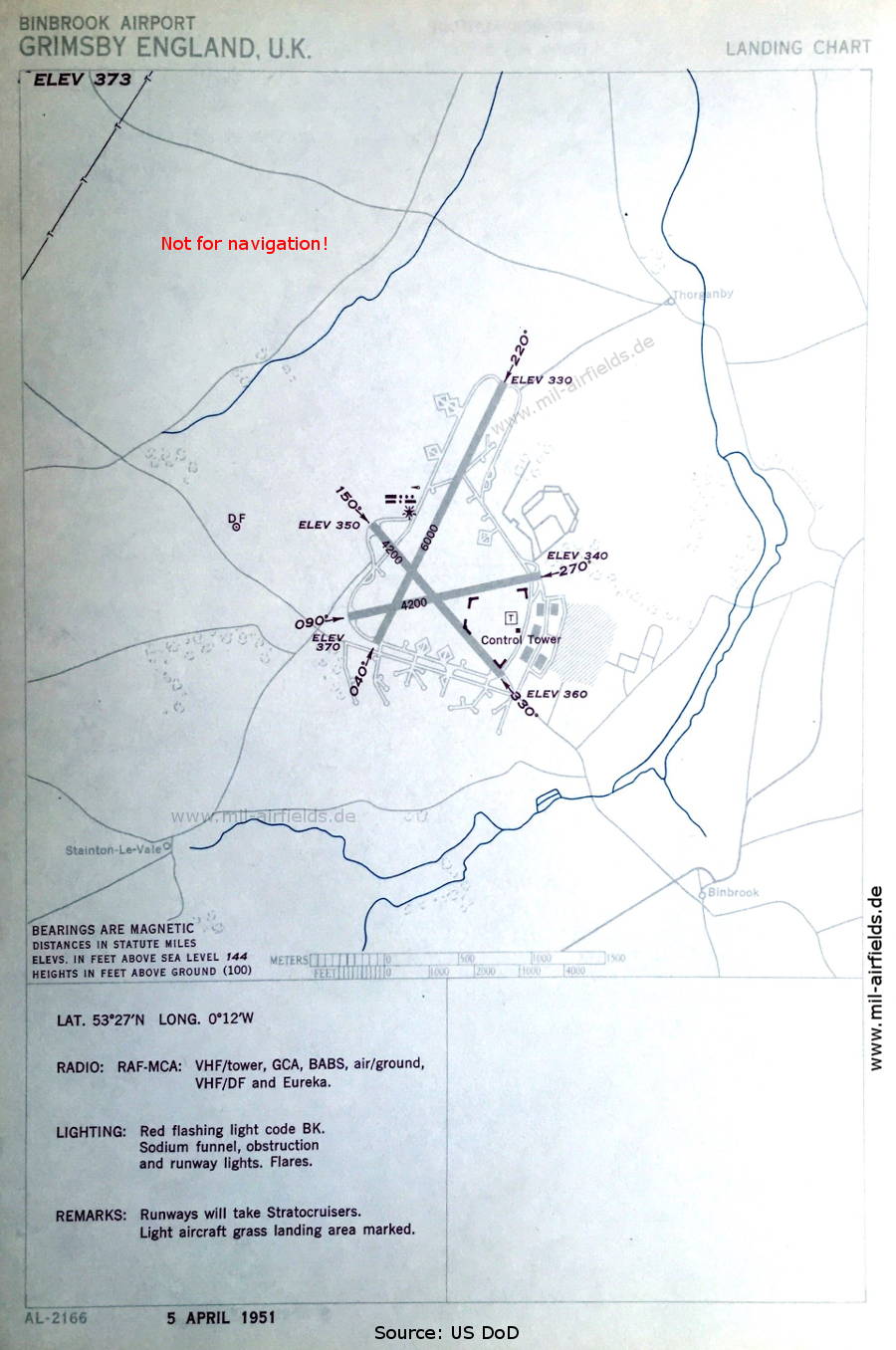

Image credits are shown on the respective target page, click on the preview to open it.
 mil-airfields.de at Facebook