For historical information only, do not use for navigation or aviation purposes!
| Coordinates | N490905 E0164138 (WGS84) Google Maps |
| Location indicator | LKTB |
The history of the Cold War airfields: Brno Tuřany
During the Cold War
In the 1960s
Runways
- 10/28: 2000 m x 60 m concrete
Radio beacons
- NDB: 363 "TB", 4.17 km to threshold runway 28
- L: 429 "B", 1.05 km to threshold runway 28
- KGSP 28: 110.3/335.0, to runway 28
- Outer Marker: 75, 4.22 km to threshold runway 28
- Inner Marker: 75, 1.10 km to threshold runway 28
Radar
Surveillance Radar (SRE)
Radio communication
- Brno Tower/Věž 3917.5, 119.1, 122.7
Weather station
Index number 11 723, telephone Brno 72985
In the 1970s
Situation
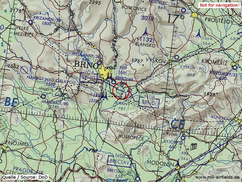
Brno Tuřany on a map of the US Department of Defense from 1973
Source: ONC E-3 (1973), Perry-Castañeda Library Map Collection, University of Texas at Austin
Overview
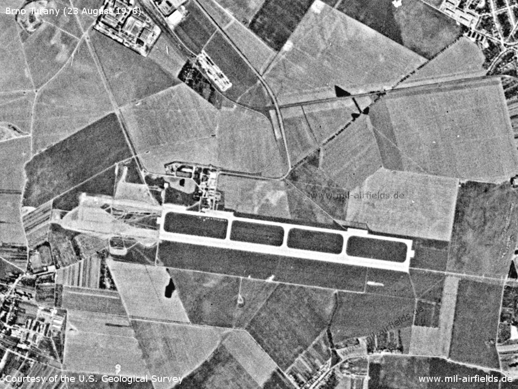
Brno Tuřany Airport on a US satellite image from 23 August 1976 - The picture shows construction work to extend the runway from 2,000 m to 2,650 m. The motorway D1 ends at the Brno-jih junction and is therefore not yet visible here.
Source: U.S. Geological Survey
In the 1980s and early 1990s
Overview
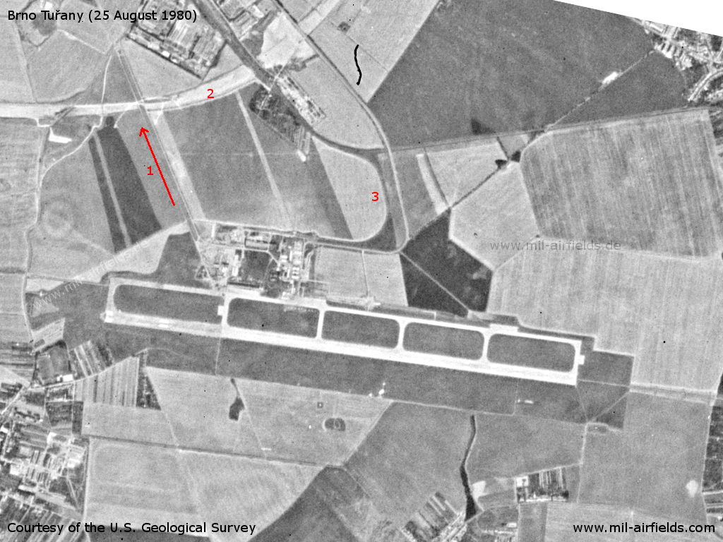
Brno Tuřany Airport on a US satellite image from 25 August 1980 - 1=Road or taxiway to Brno Slatina airfield, 2=Motorway under construction, 3=Railway siding
Source: U.S. Geological Survey
Radio communication
The call sign of the airfield was BOLERO (1990).
Units
8 SLP: MiG-21.
Airfields in the vicinity
- 326°/4km Brno: Slatina Airfield (Letiště Černovice)
- 055°/29km Vyškov: Airfield (Letiště Vyškov)
- 056°/29km Vyškov: Highway Strip
- 256°/33km Jamolice: Airfield (Letiště Jamolice)
Categories
Air Bases CzechiaRecommended
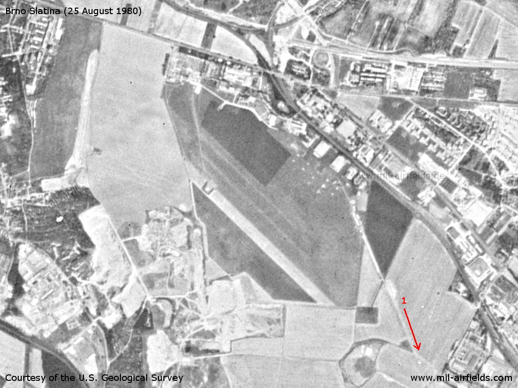
Image credits are shown on the respective target page, click on the preview to open it.
 Follow mil-airfields on Facebook