For historical information only, do not use for navigation or aviation purposes!
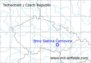
| Coordinates | N491043 E0163957 (WGS84) Google Maps |
The history of the Cold War airfields: Brno Černovice
During the 1920s/1930s
Administrator
State aerodrome Brno, Cernovice, near Brno
Airfield characteristics at daytime
On the ground inscription "Brno". T-shaped landing sign. Windsock.
Runways, taxiways, aprons
Movement area 1000 m x 650 m
Communication
Telegraphy and telephony.
Weather station
Weather bureau.
Obstacles
North: buildings, height 18 m
Hangars
Hangars.
Workshops
Small repairs.
First aid in the case of accidents
First aid at the airport.
Catering
Buffet at the airport.
Timetable
Spring/Summer 1939
The timetable for spring/summer of 1939 shows the following scheduled flights:
(Days: 1=Monday ... 7=Sunday)
(Days: 1=Monday ... 7=Sunday)
1400: Prague (Ruzyně) - Brno (Slatina) - Bratislava
- Č.S.A, Fokker IX:
123456– | Prague 16:00 - 17:00 Brno 17:10 - 17:55 Bratislava - Č.S.A, Fokker IX:
123456– | Bratislava 07:15 - 08:05 Brno 08:20 - 09:20 Prague
1401: Prague (Ruzyně) - Brno (Slatina) - Zlin - Piešťany
- Č.S.A, Airspeed AS 6, Fokker VII:
123456– | Prague 07:35 - 08:35 Brno 08:45 - 09:05 Zlin 09:15 - 09:40 Piešťany - Č.S.A, Airspeed AS 6, Fokker VII:
123456– | Piešťany 12:25 - 12:50 Zlin 13:00 - 13:20 Brno 13:30 - 14:30 Prague
1402: Piešťany - Zlin - Brno (Slatina) - Bratislava
- Č.S.A, Airspeed AS 6, Fokker VII:
123456– | Piešťany 07:15 - 07:40 Zlin 07:50 - 08:10 Brno 08:40 - 09:20 Bratislava - Č.S.A, Airspeed AS 6, Fokker VII:
123456– | Bratislava 16:30 - 17:10 Brno 17:15 - 17:35 Zlin 17:45 - 18:10 Piešťany
Departures and arrivals by time
| Days | Time | Dep/Arr | Route | Operator | Aircraft type | to/from |
|---|---|---|---|---|---|---|
| 123456– | 08:05 | Arr | 1400 | Č.S.A | Fokker IX | Bratislava |
| 123456– | 08:10 | Arr | 1402 | Č.S.A | Airspeed AS 6, Fokker VII | Piešťany - Zlin |
| 123456– | 08:20 | Dep | 1400 | Č.S.A | Fokker IX | Prague |
| 123456– | 08:35 | Arr | 1401 | Č.S.A | Airspeed AS 6, Fokker VII | Prague |
| 123456– | 08:40 | Dep | 1402 | Č.S.A | Airspeed AS 6, Fokker VII | Bratislava |
| 123456– | 08:45 | Dep | 1401 | Č.S.A | Airspeed AS 6, Fokker VII | Zlin - Piešťany |
| 123456– | 13:20 | Arr | 1401 | Č.S.A | Airspeed AS 6, Fokker VII | Piešťany - Zlin |
| 123456– | 13:30 | Dep | 1401 | Č.S.A | Airspeed AS 6, Fokker VII | Prague |
| 123456– | 17:00 | Arr | 1400 | Č.S.A | Fokker IX | Prague |
| 123456– | 17:10 | Arr | 1402 | Č.S.A | Airspeed AS 6, Fokker VII | Bratislava |
| 123456– | 17:10 | Dep | 1400 | Č.S.A | Fokker IX | Bratislava |
| 123456– | 17:15 | Dep | 1402 | Č.S.A | Airspeed AS 6, Fokker VII | Zlin - Piešťany |
During World War II
Situation
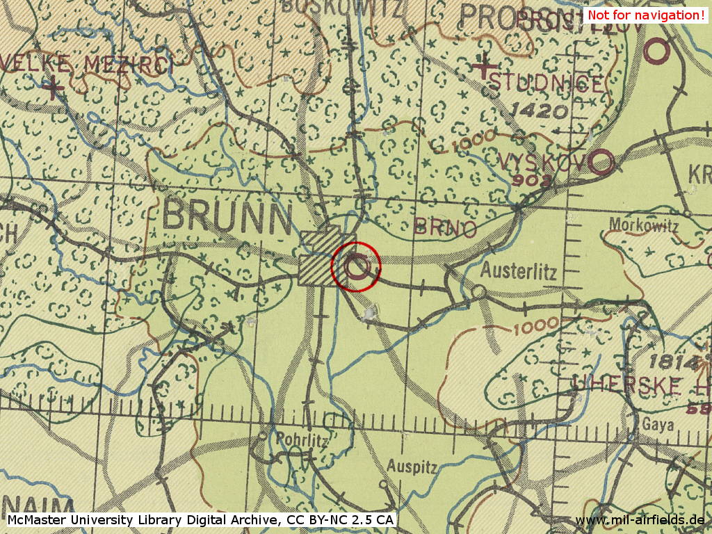
Brno Slatina Airfield in World War II on a US map from 1943
Source: McMaster University Library Digital Archive, License: Creative Commons Attribution-NonCommercial 2.5 CC BY-NC 2.5 CA
During the Cold War
Situation
Airfield and heliport.
In the 1940s
Radio communication
- Tower 6440, 2834
- OKB (direction finder) 342/339, 325/322 (A1)
In the 1950s
Radio communication
- Tower 2834, 3255, 118.1, 119.7
In the 1970s
Situation
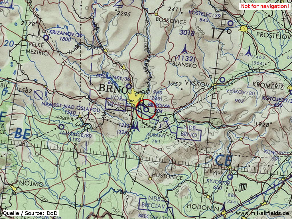
The airfield on a map of the US Department of Defense from 1973
Source: ONC E-3 (1973), Perry-Castañeda Library Map Collection, University of Texas at Austin
Overview
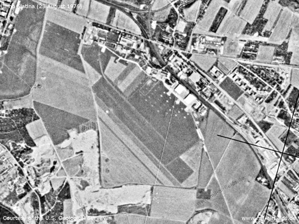
Brno Slatina Airfield on a US satellite image from 23 August 1976
Source: U.S. Geological Survey
In the 1980s and early 1990s
Overview
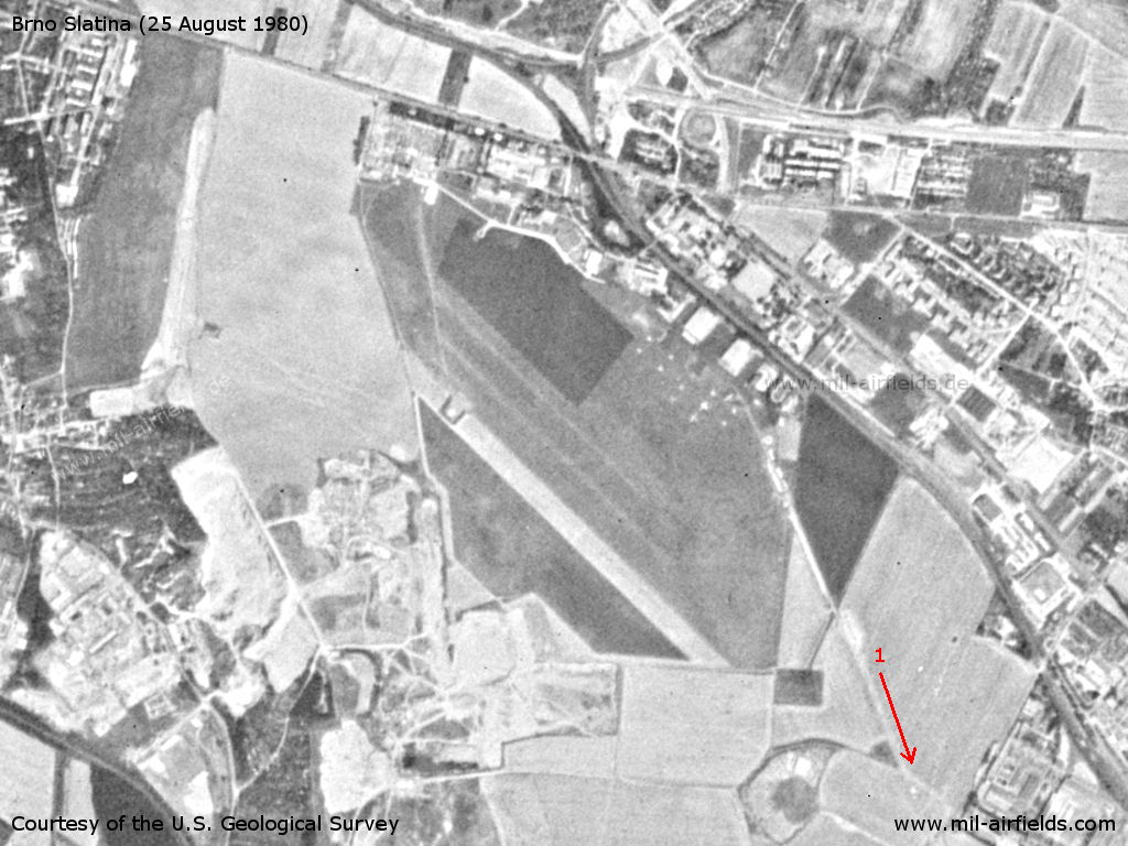
Brno Černovice Slatina Airfield on a US satellite image from 25 August 1980 - 1=Road or taxiway Brno-Tuřany airport
Source: U.S. Geological Survey
Links
Bibliography
- Ries, Karl; Dierich, Wolfgang: "Fliegerhorste und Einsatzhäfen der Luftwaffe" Motorbuch Verlag Stuttgart, 1993 - Allied map from 194x
Airfields in the vicinity
- 146°/4km Brno: Tuřany Airport (Letiště Brno, Turany)
- 062°/29km Vyškov: Airfield (Letiště Vyškov)
- 063°/29km Vyškov: Highway Strip
- 250°/32km Jamolice: Airfield (Letiště Jamolice)
- 268°/39km Náměšt nad Oslavou: Air Base (Letiště Náměšt nad Oslavou,Hartvikovice)
Categories
Air Bases CzechiaRecommended
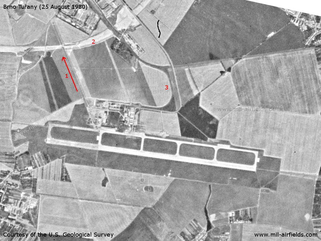
Image credits are shown on the respective target page, click on the preview to open it.
 Follow mil-airfields on Facebook