For historical information only, do not use for navigation or aviation purposes!
| Coordinates | N495809 E0080853 (WGS84) Google Maps |
| Elevation | 760 ft |
| Federal state | Rheinland-Pfalz (Rhineland-Palatinate) |
| Location indicator | EDOT (1990), EDFZ |
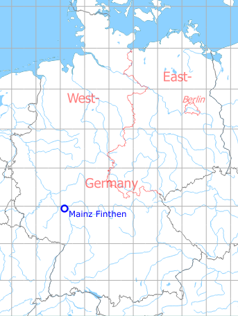
Germany during the Cold War Map
The history of the Cold War airfields: Mainz
During World War II
Use
Luftwaffe airfield.
Situation
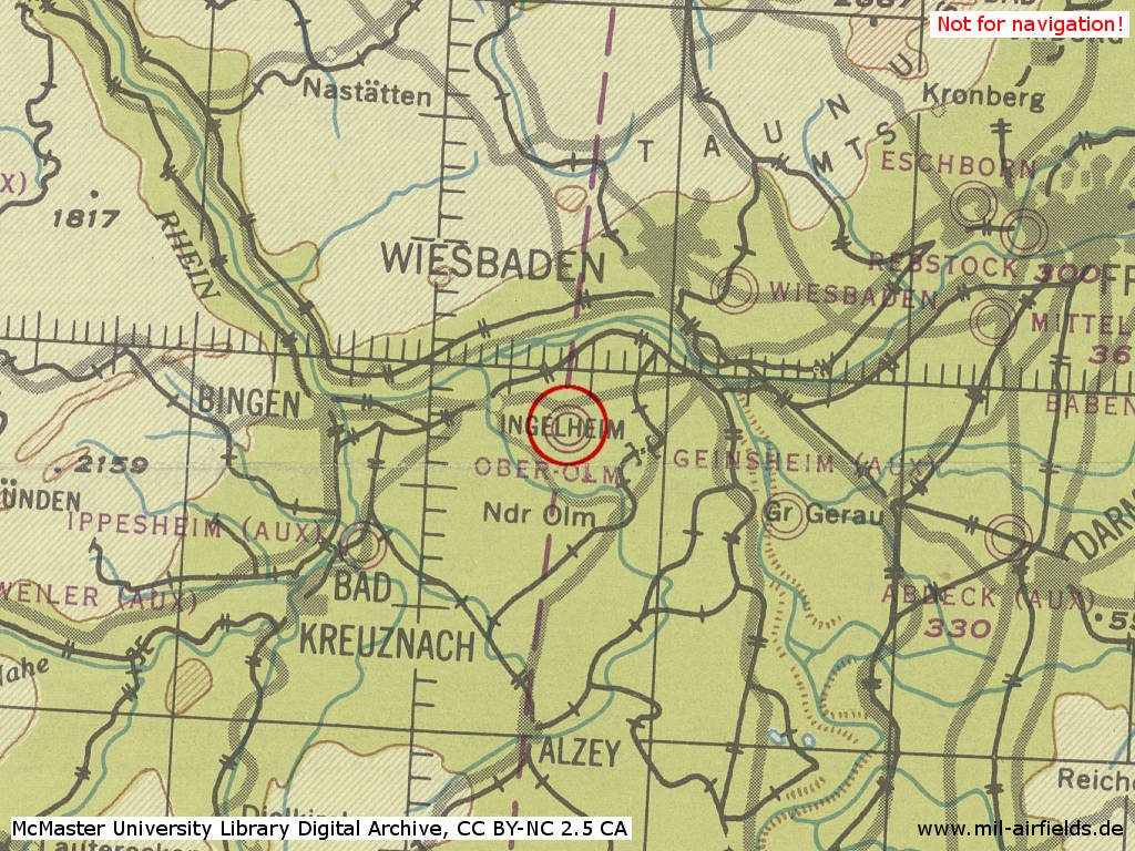
Mainz Finthen Airfield as Ober-Olm in World War II on a US map from 1944
Source: McMaster University Library Digital Archive, License: Creative Commons Attribution-NonCommercial 2.5 CC BY-NC 2.5 CA
During the Cold War
Use
US Army airfield.
Situation
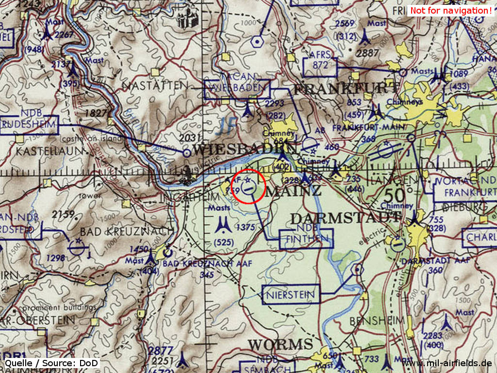
Mainz Finthen Army Airfield (AAF) on a map of the US Department of Defense from 1972
Source: ONC E-2 (1972), Perry-Castañeda Library Map Collection, University of Texas at Austin
Overview
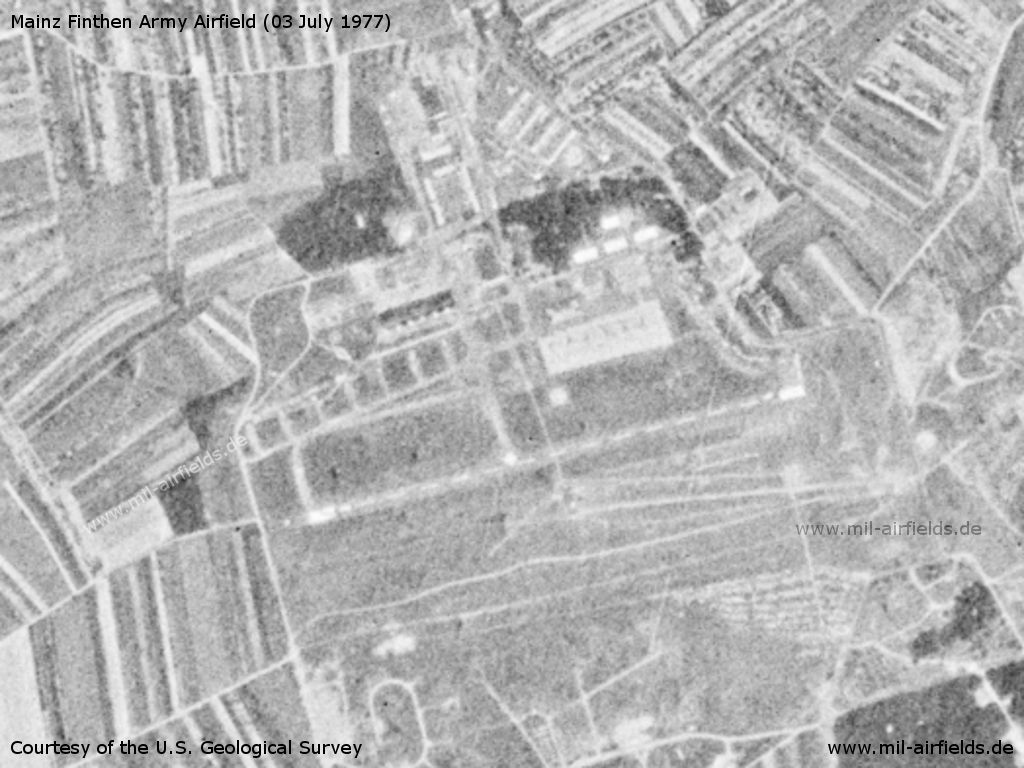
Mainz Finthen Army Airfield AAF on a US satellite image from 03 July 1977
Source: U.S. Geological Survey
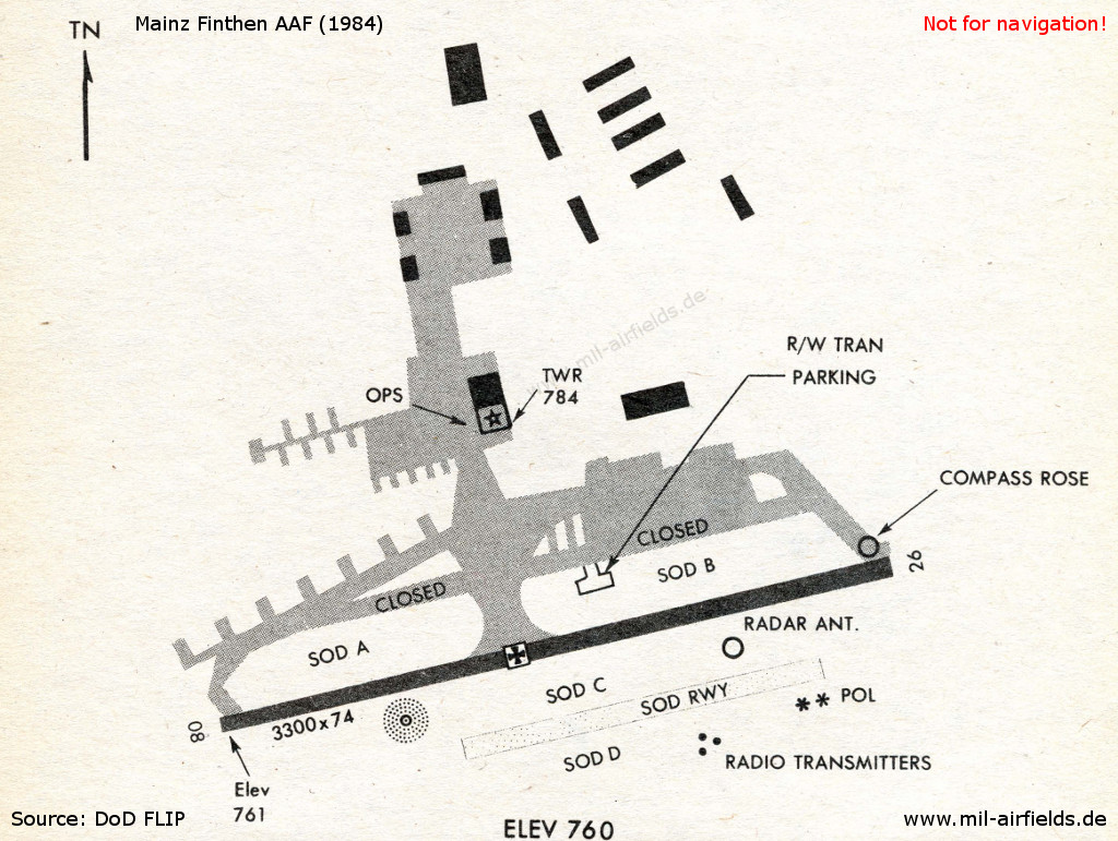
Finthen Army Airfield on a map in 1984
Runways
Data for the year 1990:
- 08/26: 1000 m x 23 m Concrete
- 08/26: 1000 m Grass
Radio beacons
Data for the year 1990:
- NDB: 470 "FY", at field
Units
1990: 2-4 Avn (21 AH-1F, 13 OH-58C, 3 UH-1H); 3-4 Avn (21 AH-1F, 13 OH-58C, 3 UH-1H); C 7-158 Avn (1 UH-1H, 16 CH-47D); I-4 Avn (2 UH-1H)
Today
Use
General aviation.
Overview
Source: Datenquelle: © GeoBasis-DE / LVermGeoRP (2019), http://www.lvermgeo.rlp.de, Datenlizenz Deutschland – Namensnennung – Version 2.0 https://www.govdata.de/dl-de/by-2-0. Es gelten folgende Regelungen zu Gewährleistung und Haftung: https://lvermgeo.rlp.de/de/geodaten/opendata/gewaehrleistung-haftung/
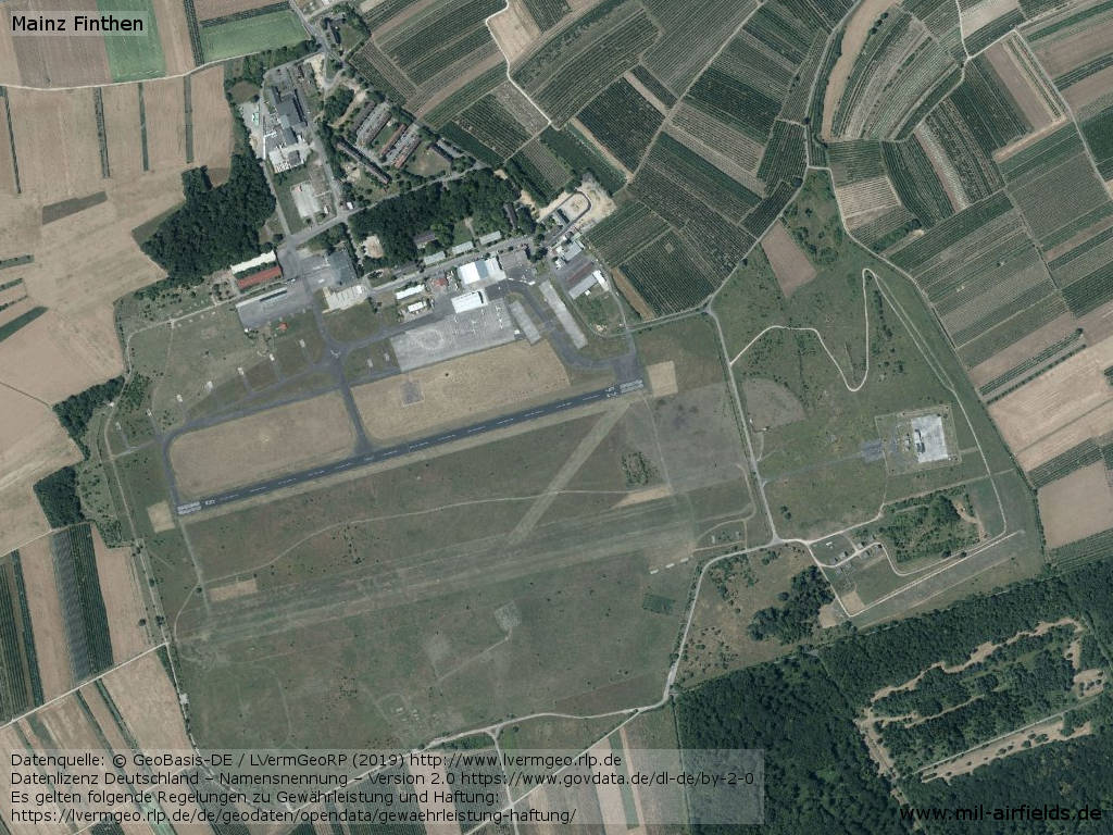
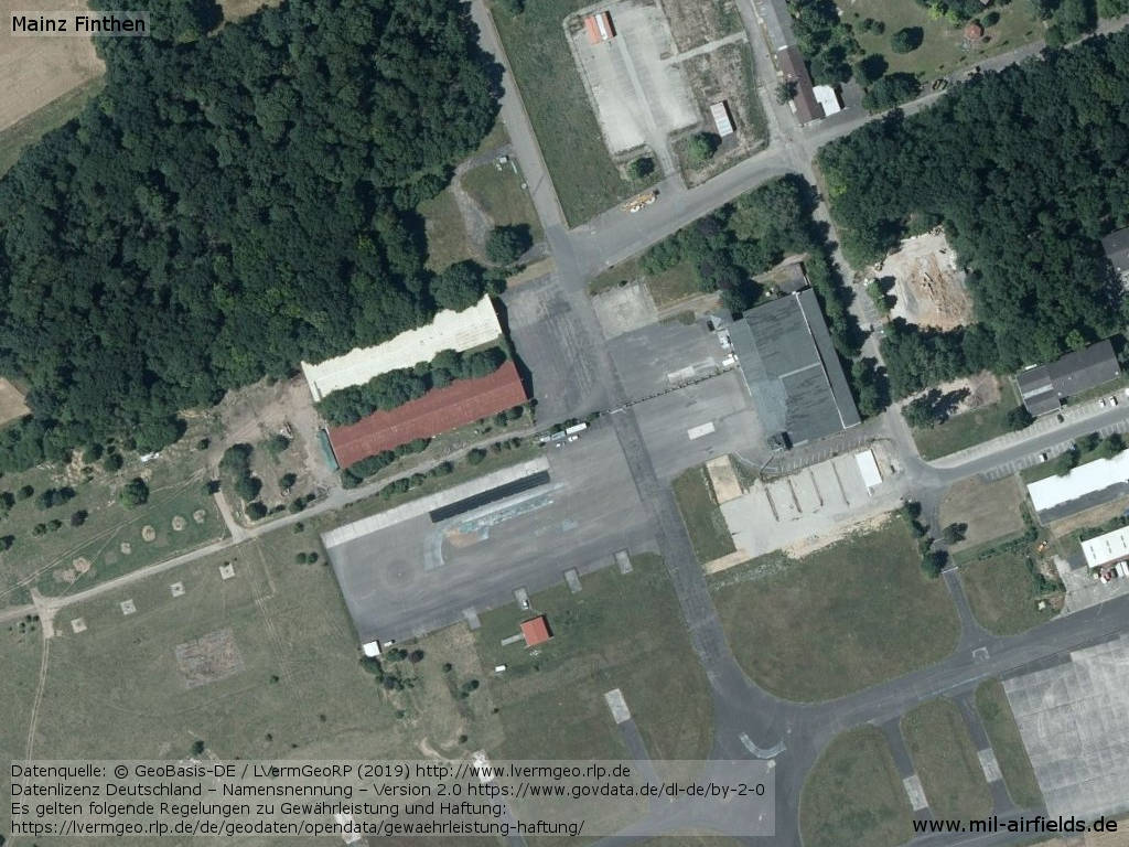
Aerial image
Airfield
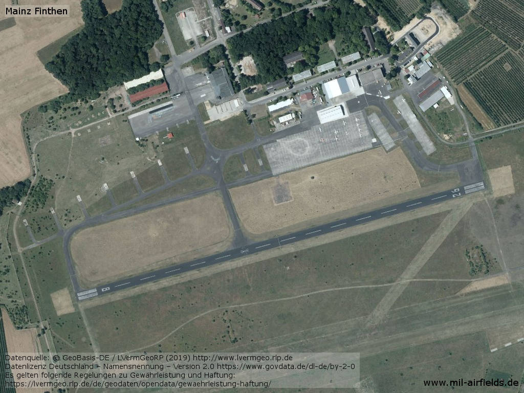
Northern part
Central part
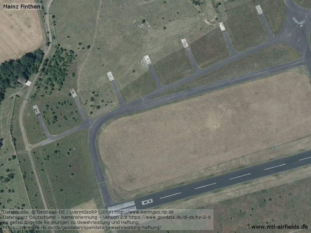
Parking pads in the west and runway
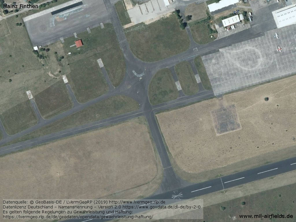
Taxiways
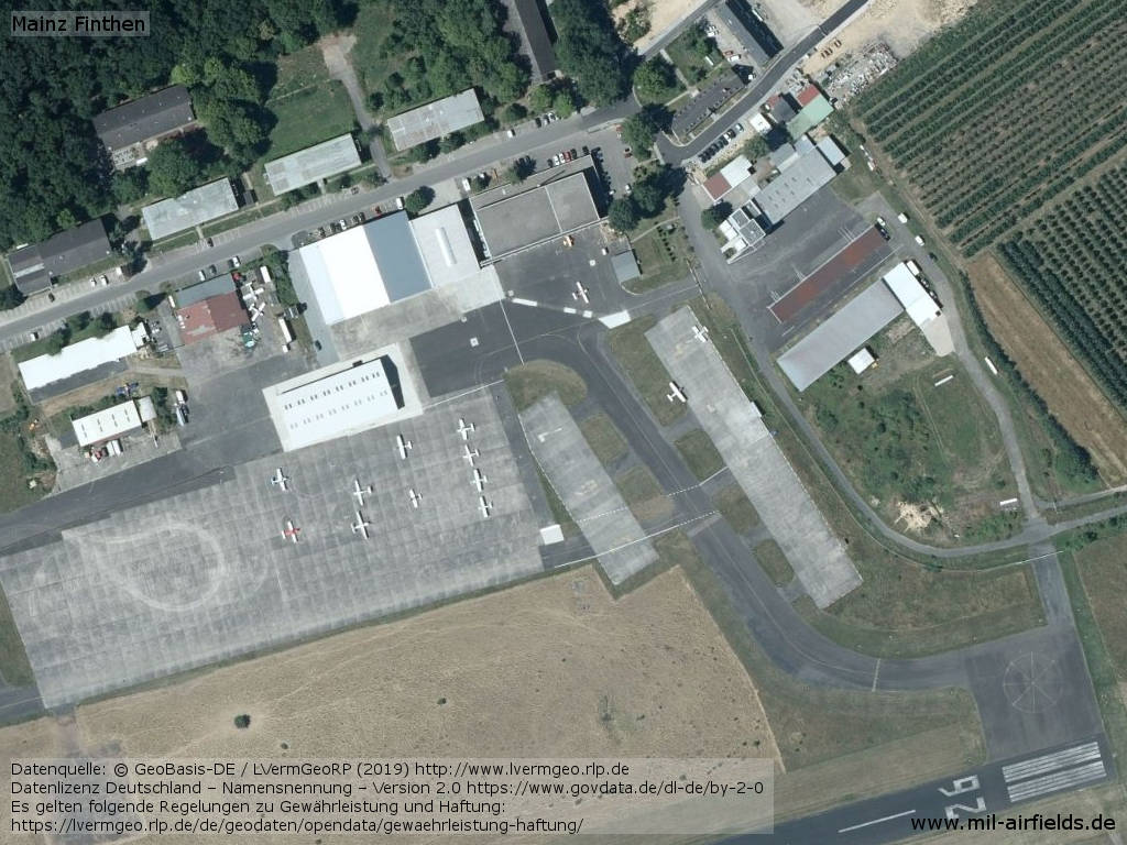
Eastern area
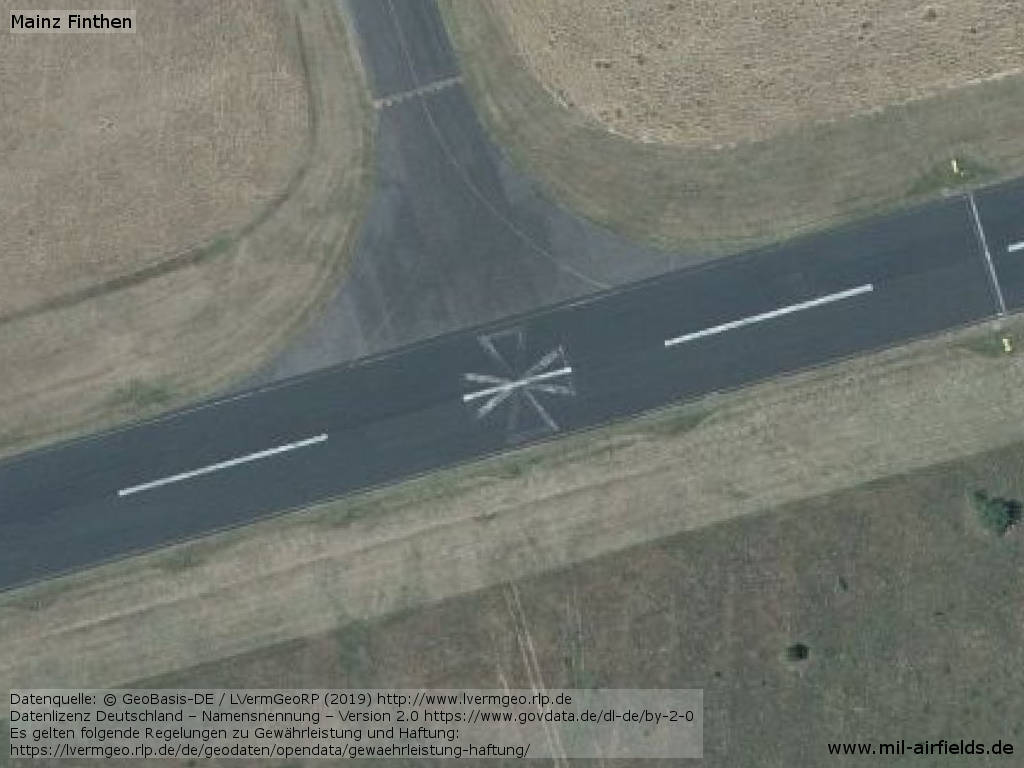
The iron cross on the runway marked the helicopter landing area
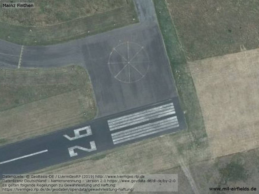
Former compass rose at the beginning of runway 26
Sources
- https://lvermgeo.rlp.de/ - Geoportal Rheinland-Pfalz
Links
- https://www.lfv-mainz.com/ - Luftfahrtverein Mainz e.V.
Airfields in the vicinity
Categories
Military Airfields GermanyMilitary Airfields in former West GermanyAirfields of the French Forces in GermanyUS Army Airfields and Heliports in GermanyRecommended
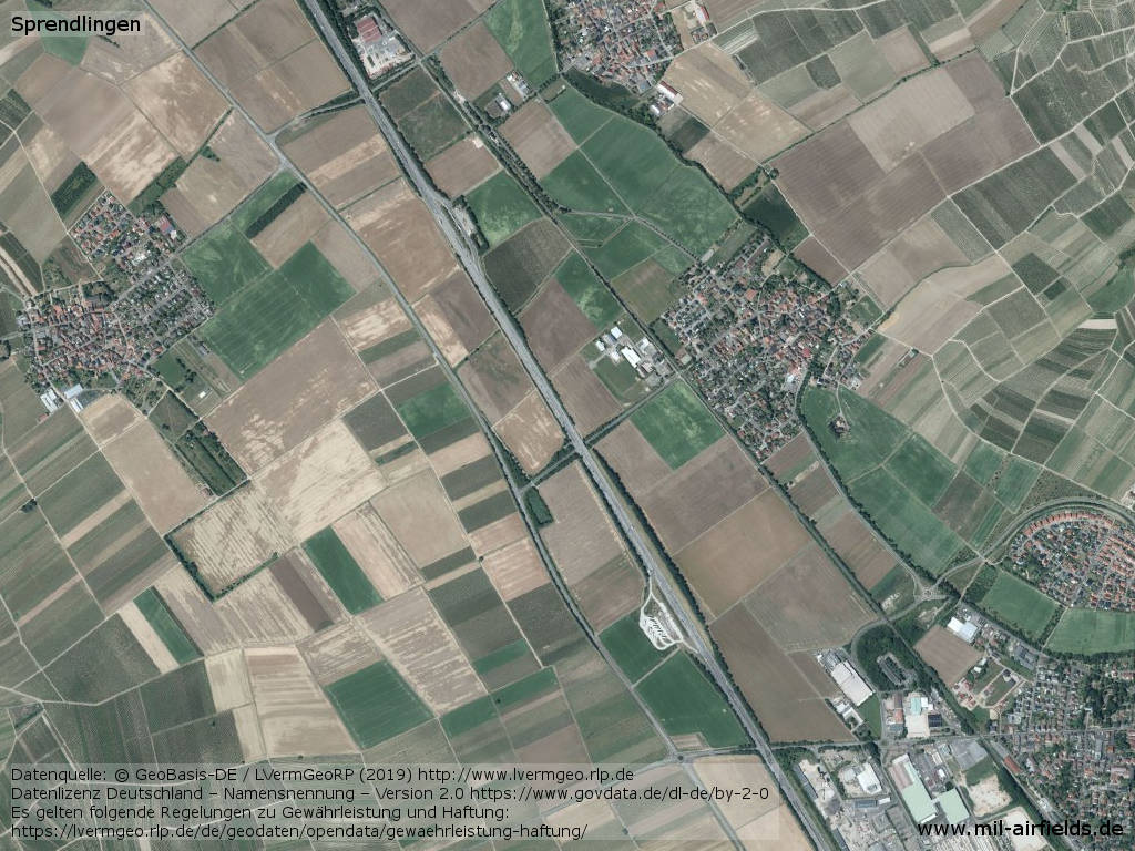
Image credits are shown on the respective target page, click on the preview to open it.
 Follow mil-airfields on Facebook